Tour de Pays Drôme des Collines
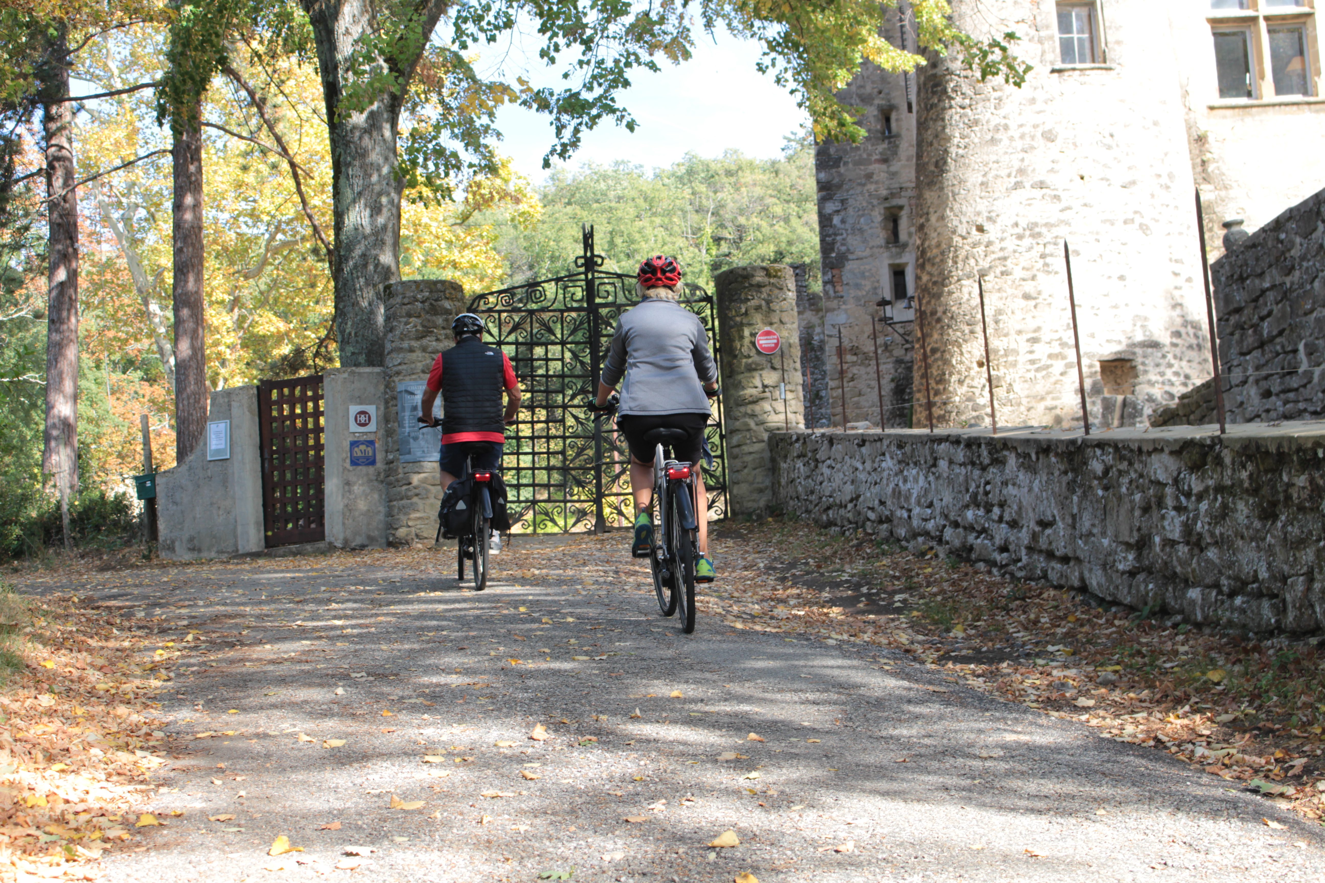
Chantemerle-les-Blés
Tour de Pays Drôme des Collines
Hard
10h
155,3km
+0m
0m
Embed this item to access it offline
12 points of interest

 Flora
FloraTain l'Hermitage vineyards
The Hermitage slopes are the symbol of Rhodanien landscapes and are part of the most beautiful wine-growing areas in the region. At the heart of the northern Côtes du Rhône vineyards, this site was classified in 2013. Covering all the southern facing hillsides and offering an interesting, historical and beautiful landscape all add to making this great vineyard a good visual reference.
Old washhouse of the Veaune river
As from 1890, many towns and villages started to erect communal washhouses. Some counsellors came up with the idea of building one along the edge of the river Veaune enabling the washerwomen to work on both sides. Unfortunately, the owner of the land on one of the sides was not in agreeance so the council had to reconsider the project. They decided therefore on a one-sided, sheltered washhouse in 1896. Consequently, washerwomen had to take turns to do the laundry. Along the edge of the river the soapwort plant was very useful for scrubbing the laundry. Its rich content of saponin gave it extremely high cleansing properties. Around 1960 the washhouse stopped being used when water supply in the home became available. Information source : cartepatrimoine.ladrome.frThe château of Génissieux
The Château Messance was built in the XVlllth century in the centre of the village. The beginning of the work was on demand of M Jomaron de Montchorel and completed by Jean-Baptiste Maisonneuve and his son François Benoît. The castle was bought in 1828 by Hippolyte Charles who was the lover of Joséphine de Beauharnais. Information source WikipediaMontmiral
The name de Montmiral is of latin origin Montmiratus, meaning « the hill from where we can see clearly ». The village does in fact date back to Antiquity as Roman remains have been found here. Throughout time the village has known several churches and is the result of the joining together of two of the latter : St Christophe, St Michel sur Savasse and St Martin. The day after the French Revolution the different churches separated. The Saint-Christophe church, around which the present village was built, has an old bell tower and two apses of Roman style, whereas the painting and architecture inside are of art nouveau style. Its stained glass windows are from the 1900s and made by the glass painter L. Balmet. Information source : Wikipedia
Saint Antoine l'Abbaye
Classified amongst historical monuments since 1946, St Antoine l’Abbayé is also one of the most beautiful villages of France. Many well restored buildings of the Abbey overlook the medieval village with its tiny streets and old houses (XIVth – XVth century for the oldest amongst them). The abbey of Saint-Antoine was built to house relics of Saint Anthony of Egypt. Its facade is of flamboyant gothic style and was erected in 1297. The abbey has several structures : the abbot house, the great cloister, the great refectory hall, rooms for the profession of vows and noviciate, library, infirmary, stables and gardens. Most of them were transformed during the XVIIth and XVIIIth centuries.- Flora
The forest of Chambaran
Classified amongst the national natural heritage the plateau des Chambarans is a vast clayey zone and a genuine water reservoir for the surrounding land. This forest was the mark of human settlement during the Antiquity era as we can find traces of an oppidum. From XlVth to XVlllth centuries numerous glass factories were established in the area finding the wood needed there to fire the ovens. During the second world war this forest was used by the Maquis members as a refuge and as a base behind the lines for the Vercors Resistance. Nowadays the plateau of Chambaran is a nature park stretching over 240 enclosed hectares, with hilly forests and ponds welcoming a rich fauna (various deer species, wild boar, rodents, birds…) and is also a military base. Le Grand Serre
Le Grand Serre is a medieval village perched on the top of a hill overlooking two rivers. The market hall built in the Middle Ages, its church dating back to the Xlllth century, its ramparts, narrow streets, stone and molasse house fronts are all evidence of a long history. Information source : Townhall of le Grand SerreMoras en Valloire
The history of Moras starts at the top of its hillside overlooking the area of Valloire and watching over its pear orchards. Archeological digging in the 1970s revealed dwellings dating back to the Neolithic era (around 6000 years ago) and especially engraved pottery decorated with symbols indicating the existence of a civilisation. In archeology these almost unique symbols form a type called « morassian”. From an etymological point of view Moras means “butte” (mound) according to one theory or “marais” (marsh) according to another. As for the name « Valloire » (Vallis Aurea, the valley of gold), it was given by the Romans referring to the valley of fertile soil. This ideally situated hillside has always been an attraction to mankind. At the top there used to be a castle which started out as a simple watchtower round year 1000 becoming by the end of the Middle Ages an impressive fortress. Finally the French Revolution then the 19th century marked the end of administrative power in the village of Moras. The fiefdom then split up into several independant villages. Information source : Townhall of Moras en ValloireThe château of Lapérouze
A beautiful edifice visited by Napoleon lll. It has become one of the best places in the area for tourists to stay nowadays, offering high-standard accommodation.The château of Cros
With its circular turrets the château of Cros is one of the most remarkable edifices in Anneyron. Today it has become a holiday gîte and gives the owners the feeling they are lord and lady of the manor !Anneyron
Before 1790 Anneyron was a parish belonging to the Diocese of Vienna. Its church dedicated to Notre Dame was a priory depending on Saint Peter’s church of Vienna, first becoming known in 1276 and united afterwards with the latter giving it the right to collect the tithes of Anneyron. The parish was part of the community and mandate of Albon and belonged to this town up until 4th May 1809. On this date the parish joined the village of Mantaille to make up the district of Saint-Vallier with the former as a sort of annex.Saint Vallier sur Rhône
To the south of the town of Vienne as you come to the « défilé » (winding flow of the Rhône) going as far as Tain l’Hermitage, you can see the town of Saint Vallier and its hillside “Montrebut” along the left bank of the river. The river Galaure joins the Rhône at this point. The town has always been a place for exchange, trade and craft industries as great routes have always passed through such as the Roman way « Agrippa », the Royal road and nowadays the main, very busy National 7 road.
Description
1 - 0 km
Here in Tain l’Hermitage, the great wines of northern Côtes du Rhône carry the national label Vignobles & Découvertes « d’Hermitage en Saint Joseph ». In addition to that, the chocolate fragrances emanating from the Cité du Chocolat ValRhona will titillate your senses. A real treat for your tastebuds, rich in tannins. But best to keep for the return journey….
2 – 4.6 km
Head for Larnage then Chantemerle les Blés surrounded by terraced vineyards.
3 – 8.2 km
In Chantemerle les Blés you can visit the church Notre Dame, a gem of Roman art dating back to 11th and 12th centuries.
4 – 10.7 km
The trail then takes you up and down hills and on the way, past the small lake of Mouchet in Chavannes. The pond is a sensitive nature reserve developed for learning about the fauna and flora of the wetlands and is also an ideal place for relaxing under some of the impressive trees there.
5 – 21.7 km
In Saint Donat why not take a swim at the Lake Champos. A slide along with other activities will delight the young and not so young ones. Others may prefer visiting the old town with its collegiate cathedral where each year the Bach Festival takes place in June and July.
6 – 36.9 km
The trail then continues through the « green lung » of Drome des Collines along the valley of Herbasse to Peyrins near the town of Romans, famous for its industrial and craft heritage (leather and prêt à porter Made in France).
7 – 71.2 km
It then carries on to Montrigaud with its pond named Joana Maria where fisherman and tranquillity make it a place to be appreciated. This section, more difficult physically than the two previous ones, has steep uphill inclines. All along, the magnificent views of the Vercors mountains add to its beauty. Worth seeing along the journey, in the neighbouring county Isère, is the medieval village of Saint Antoine l’Abbaye, classified as one of the most beautiful villages in France. As you leave Montrigaud the landscape becomes mainly forest land.
8 – 77.2 km
The trail then takes you through forests, one after the other, such as the forest of Thivollet and Chambaran, going as far as Roybon.
9 – 95.4 km
Arriving in le Grand Serre with its medieval market hall, you are back in Drôme. From here you head to Hauterives and the famous Palais Idéal du Facteur Cheval, a gem of art brut where music concerts, including jazz, take place every year in June and July.
10 – 118.6 km
Some steep uphill sections and great downhill slopes will then take you to the town of Saint Vallier. Why not make a few stops on the way in Moras en Valloire for instance, a pretty medieval village at the heart of the region, granted the label « site remarquable du gôut » for its succulent pear. Another village is Anneyron with its frescoes in the choir of the church Notre Dame or its outlets like Lafuma or Jars pottery.
11 – 124.4 km
You come next to Albon with its classified medieval watchtower. At that point you have plenty of time to warm up as it’s mostly downhill from here to Saint Vallier.
12 – 141.8 km
Saint Vallier and the majestic meanders of the Rhône, is the beginning of a succession of views overlooking the great river, the hills of Ardèche and Pilat as well as the Galaure Valley. Another place worth seeing and only a few kilometres away, is the natural site of the Roches qui Dansent in Saint Barthélémy de Vals. Finally the trail zizags through many orchards and terraced vineyards heading towards Larnage then back to Tain l’Hermitage.
- Departure : Tain l'Hermitage -Tourist office
- Arrival : Tain l'Hermitage -Tourist office
- Towns crossed : Chantemerle-les-Blés, Charmes-sur-l'Herbasse, Chavannes, Crozes-Hermitage, Érôme, Hauterives, Larnage, Margès, Mercurol-Veaunes, Montmiral, Montrigaud, Peyrins, Saint-Donat-sur-l'Herbasse, Saint-Sorlin-en-Valloire, Saint-Uze, and Tain-l'Hermitage
Information desks

6, place du 8 mai 1945 - BP 70019, 26601 Tain l'Hermitage
Transport
Bus route N° 4 Valence - Tain l'Hermitage - Serves sur Rhône
Access and parking
Follow the N7 from Valence towards Lyon as far as Tain l'Hermitage.
Parking :
Market Square (Vélodis)
Accessibility
- Emergency number :
- 114
More information
Report a problem or an error
If you have found an error on this page or if you have noticed any problems during your hike, please report them to us here: