Montplot
Saint-Victor
Montplot
Medium
3h
7,4km
+272m
-270m
Embed this item to access it offline
5 points of interest
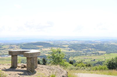
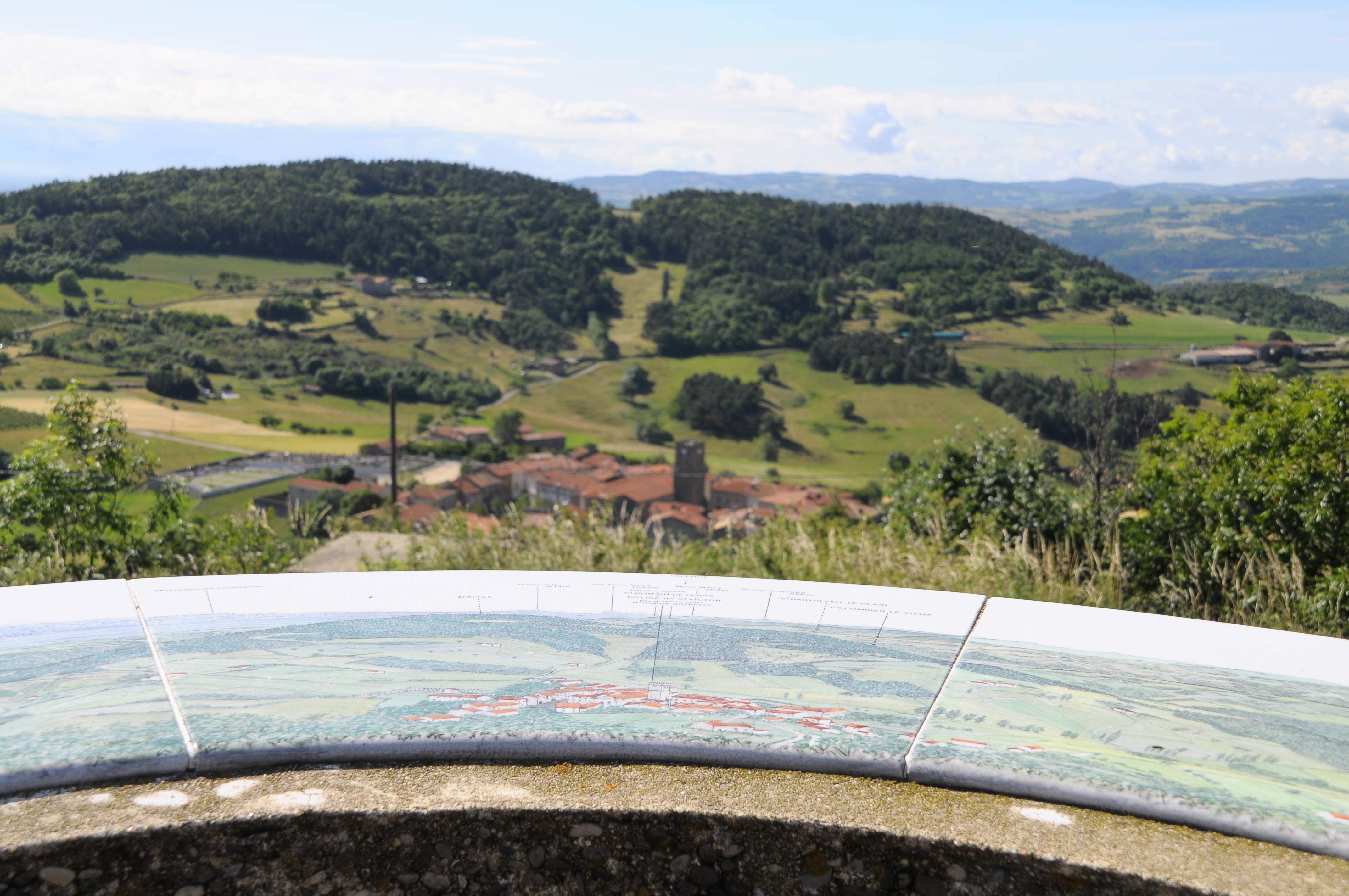
Vue de la table d'orientation - Ardèche Hermitage Tourisme  Panorama
Viewpoint indicator
This viewpoint indicator overlooks the village of Saint Victor and offers a 180° panoramic view. It indicates the countless villages that can be seen from there along with the different distant alpine peaks including the Mont Blanc in the background.
 Small patrimony
The terraces
In this area "Chalets" is the word used to describe terraces on slopes making them useable for various cultures. Most of the terraces were built in XVlllth and XlXth centuries. At that time, the population, 90% of which were farmers, was on an increase. Always looking for land to cultivate, quite simply to survive, the latter were forced to use the steep slopes. Vine growing was also on an increase during that same period and necessitated arable land. Building terraces was the answer; increasing surfaces for growing and at the same time making the slopes easier to use, enabling water retention and controlling it, keeping the soil from erosion and restoring the heat absorbed by the rock-stone during the day. Little by little the use of these "chalets" was abandoned due to various plant diseases at the end of the XlXth century, particularly Mildew and Phylloxera that destroyed whole vineyards and crippled farming. However, rural depopulation, the number of lives lost during the first World War and the mechanization of farming down in the lower plains were the main reasons for terraces being abandoned. As you stroll along you will discover a landscape shaped by these « farmer builders”. Here, amongst this stone architecture, traces are particularly visible, making it easy to imagine the magnitude of the task.- Small patrimony
The cross of Montplot
Joannès Dufaud (parlarem en Vivarés edition 2004) describes it as a mountain of timber and wood stumps or quite simply a mountain where trees are logged and cut into ¾-metre lengths as in a wood yard. We can in fact observe here, that the way of working hasn’t changed much over the years. Information source : Ardèche Sports Nature. - Panorama
Viewing point
Discover here a splendid view of the Daronne and Doux valleys - Panorama
Viewing point
Splendid views of the Doux and Daronne Valleys from here
Description
1 - Saint Victor - 610 m Follow Table d'orientation 800 m Montplot 4.3 km
Follow the GR route going past the church entrance then continue ahead on a small lane to come out of the village.
2 - Chemin de Croix - 630 m Follow Table d'orientation 500 m Montplot 3.3 km
Turn right off the GR trail onto chemin de croix, a windy track going up to the orientation table. Once there, carry on uphill on the small road.
3 - Gounon - 722 m Follow Montplot 2.2 km
Turn right (GR) again on a tarmac track leading up between terraces and emerging rapidly into woodland. Keep on the main track. The path goes through a hamlet in ruins then comes to a crossroads la Croix de Montplot. Turn right onto the path taking you over to the other side of the hill, much more exposed since the violent winds in 1999. Here you overlook the village of Préaux and town of Annonay. Carry on along the track leading to the lovely hamlet Montplot.
4 - Montplot - 785 m Follow Saint Victor 4.1 km
Come off the GR trail onto the main track taking you up to the ridge. Come down past the house Vignet then follow the small road going between fields.
5 - Les Brudonnes - 739 m Follow Saint Victor 2.9 km
Carry on down the small road zigzagging between fields on terraces. At the fork turn left and go uphill back onto the GR trail which bears right.
6 - Les Bauds - 692 m Follow Saint Victor 1.7 km
Go down the track and once you reach the road turn left.
2 - Chemin de Croix - 630 m Follow Sant Victor 300 m
Head back to Saint Victor.
- Departure : Saint Victor - Village square
- Arrival : Saint Victor - Village square
- Towns crossed : Saint-Victor and Vaudevant
Altimetric profile
Information desks

6, place du 8 mai 1945 - BP 70019, 26601 Tain l'Hermitage
Transport
Bus route N° 11 Tournon sur Rhône - Saint Félicien - Lalouvesc
Access and parking
Follow the D238 then the D532 towards Saint Félicien until you get to Saint Victor.
Parking :
Village square
More information
Report a problem or an error
If you have found an error on this page or if you have noticed any problems during your hike, please report them to us here: