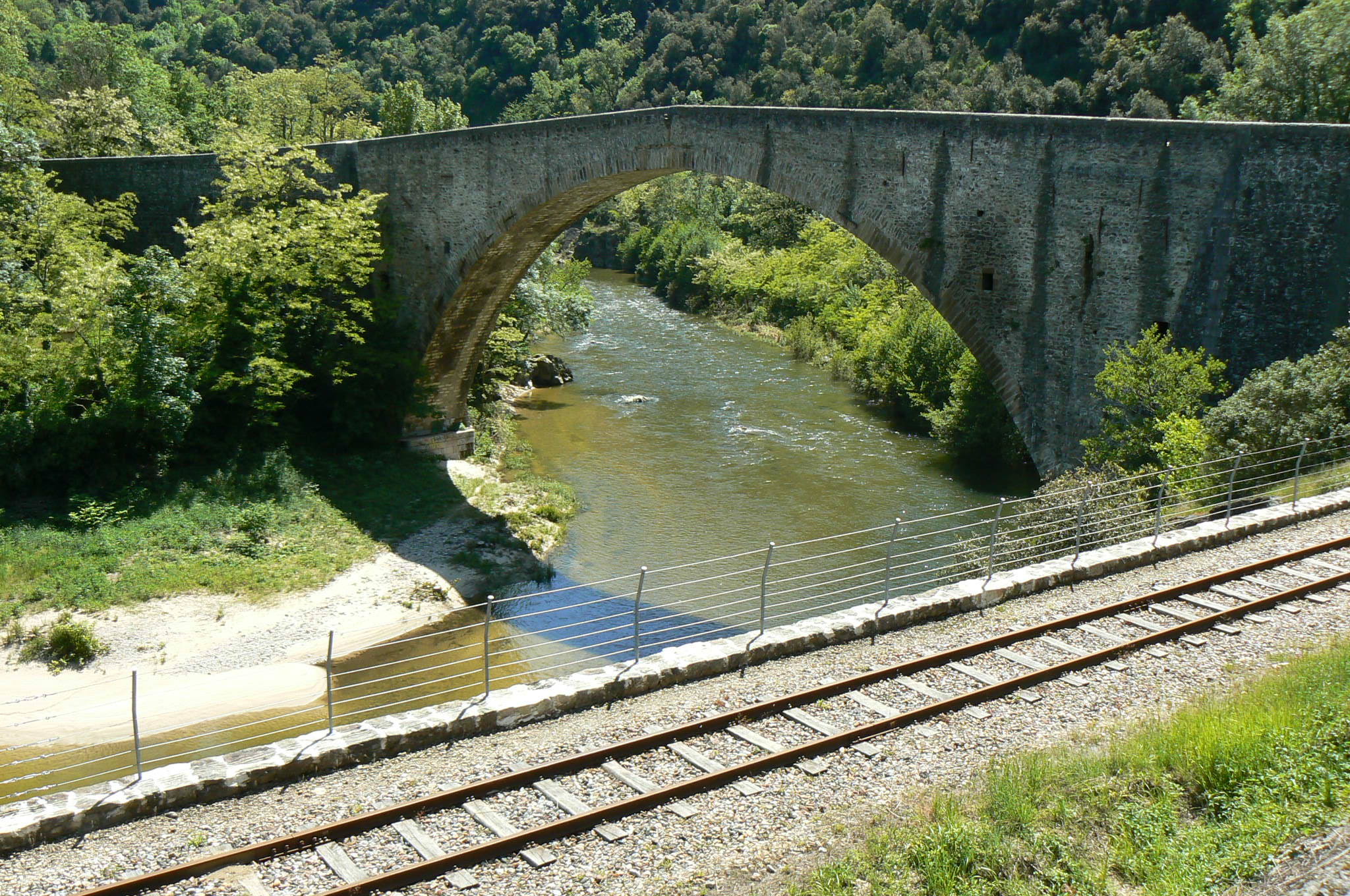
Le Grand Pont
Saint-Jean-de-Muzols
Le Grand Pont
Easy
2h
5,4km
+342m
-341m
Embed this item to access it offline
3 points of interest

 Panorama
Viewing point
Occasional view of the Doux gorges and a few old terraces some of them which are still looked after today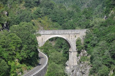
Pont des Etroits - Ardèche Hermitage Tourisme  Flora
FloraThe Doux Gorges
The path finds its narrow way through dug out rocks downstream from the village of Boucieu le Roi. Very often it runs directly upon the rock along the narrow river gorges between sheer cliffs. Some parts can only be accessed via the train running along the valley floor. The arid character of these rocky surfaces, linked with the climate of the Rhône Valley, make for a strong mediterranean influence concerning the fauna and flora in the area. Green and white bark oaks, along with broom bush and heather moors now cover the steep slopes in places where, in time gone by, animals used to graze or they were used for various cultures. Amongst the fauna living in this rocky climate are different reptiles : the green and yellow grass snake is very common, the endemic southern smooth snake along with wall lizards Some crags are ideal nesting places for the very rare eagle owl. Information source : SIVU Doux Clair, Conservatoire Rhône Alpes des Espaces Naurels, la Vallée du Doux, un voyage aux multiples ambiances, Natural Heritage guide of the Rhône Alpes region, 1995.
Hydroelectric plant of Mordane
During the first world war the French government decided to considerably increase the production of electric energy. A new water impoundment was built in order to supply a hydroelectric plant situated downstream from the existing site of Mordane. In order to link the two structures together a company « Société des Forces Motrices du Vercors » led the project of building a 2-kilometre long canal along the river Doux gorges between 1917 and 1920. Part of the work was done by German war prisoners giving it its name « canal of the Germans » It was taken over by the EDF company in 1946 and is still working today with an average yearly production of 11GWh.
Description
1 - Le Grand Pont - 142 m Follow Les Terres Grasses 1.9 km Etables 9.4 km
Be careful as you follow the D532 for about 200m before turning left onto a path going into a wood of oak trees. At the following crossroads continue ahead. After a while when you come across the stream, step over and feel the coolness it offers. Continue uphill to a road. Turn right and carry on until you get to the ridge.
2 - Les Terres Grasses - 380 m Follow Le Grand Pont 3.5 km
Take the small track going down to the road. It becomes quite sinuous offering some beautiful views of the curve in the river Doux below. Further down, above the maison de la Vallée, you go into a chestnut grove. Carry on to the maison de Gouny then follow the path uphill alongside the field. Head for the road then go uphill to your left then right after the maison de Monerone. Turn left and go down the main path back to the starting point.
- Departure : Saint Jean de Muzols - At the entrance to le Grand Pont on the left bank (route de Saint Félicien)
- Arrival : Saint Jean de Muzols - At the entrance to le Grand Pont on the left bank (route de Saint Félicien)
- Towns crossed : Saint-Jean-de-Muzols and Lemps
Altimetric profile
Information desks

6, place du 8 mai 1945 - BP 70019, 26601 Tain l'Hermitage
Transport
Bus route N° 11 Tournon sur Rhône - Saint Félicien - Lalouvesc
Access and parking
Follow the D532 from Tournon sur Rhône towards Saint Félicien, stopping at le Grand Pont.
Parking :
At the entrance to le Grand Pont on the left bank (route de Saint Félicien)
More information
Report a problem or an error
If you have found an error on this page or if you have noticed any problems during your hike, please report them to us here: