Col du Gibet

Saint-Félicien
Col du Gibet
Very easy
1h
9,8km
+272m
-275m
Embed this item to access it offline
4 points of interest

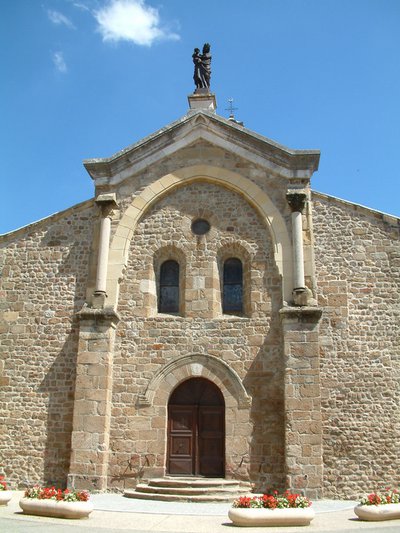
Eglise romane de Saint Félicien - Ardèche Hermitage Tourisme 
Saint Félicien and its church
Written records about the village of St Félicien were discovered as from the Xth century. Monks from St Barnard’s collegiate (Romans sur Isère) came here to build a priory. The village developed round the chapel of the priory that then became the parish church. Push the door to discover its interior. The choir is a good example of early Roman art of the Xlth century. The low southern side was partly destroyed and rebuilt towards the end of the Middle Ages. The style is more sober with broken bows.
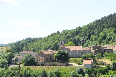
Vue d'ensemble du village - Ardèche Hermitage Tourisme 
Vaudevant
Mention of the village was already found during the Xlllth century. Its name would originate from « Val des Vents », « les Avents » (referring to wind) being a small hamlet situated at the top of the village. In 1090, the village became part of the town of St Félicien and joined the canons of St Barnard chapter (Romans sur Isère). However, following long negociations the village regained its autonomy in 1790. Small patrimony
Stone Masks
As you go past the church in Vaudevant glance at the apse to see its joyful little devil pulling his tongue out, seeming to make fun of you. Other enigmatic masks of this kind decorate walls of houses in the village and the whole of the area around Saint Félicien. Very often you find them on the outer walls of churches, on rich dwellings, on mission crosses or simply on walls of homes in the country villages. Of all ages and forms their presence remains rather mysterious and leads to various explanations…… even the most far-fetched ones. For fun, whimsical ideas of stone cutters, religious beliefs and superstitions dating back to our celt ancestors, symbols of protection… What do these human faces truly represent, peering at us with such distinctive expressions? Why not just let your imagination run riot. Information source : Le chemin des masques, région de Saint Félicien, association Histoire et Patrimoine Panorama
Viewing point
View of the village of Saint Victor
Description
1 - Saint Félicien
Go across the square and left past the old butcher’s shop then right just before the stone porch.
2 – The park
Continue ahead on the road then bear left at the fork. Go round the park on the top side. At the stop sign head uphill on the main road going towards Lalouvesc. When you reach the sign indicating leaving the village, bear left. The small road becomes a wide track.
3 – Châtelas
Carry on along the main path that becomes a grass path further on. Go through the turnstile leading to the château de Rosières. At the gate continue ahead then through another turnstile to go out. Go under the porch on the windy, uphill path to the main road. Go down the road a few metres then left onto a path beginning with a pretty steep incline. On the small lane take the path facing you going along a field then into woodland and coming out into an orchard. Turn right onto the small road.
4 – Char
Bear left along the house with a swimming pool. Go into the picturesque village of Vaudevant.
5 – Vaudevant
Carry on down the main road towards Saint Félicien then immediately left onto an interesting path running parallel to the road you will join further on.
6 – Sauze
Carry on along the main road and turn left on the next bend. The lane becomes a path running parallel to the main road that you need to get back on and then continue along to the village.
- Departure : Saint Félicien - Post office car park
- Arrival : Saint Félicien - Post office car park
- Towns crossed : Saint-Félicien and Vaudevant
Altimetric profile
Information desks
6, place du 8 mai 1945 - BP 70019, 26601 Tain l'Hermitage
Transport
Bus route N° 11 Tournon sur Rhône - Saint Félicien - Lalouvesc
Access and parking
Follow the D238 then the D532 from Tournon sur Rhône to Saint Félicien.
Parking :
Post office car park
Accessibility
- Emergency number :
- 114
Report a problem or an error
If you have found an error on this page or if you have noticed any problems during your hike, please report them to us here:

