Le Moulin des Gaillards
Saint-Félicien
Le Moulin des Gaillards
Medium
2h30
8,3km
+296m
-296m
Embed this item to access it offline
6 points of interest
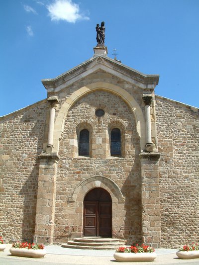
Eglise romane de Saint Félicien - Ardèche Hermitage Tourisme 
Saint Félicien and its church
Written records about the village of St Félicien were discovered as from the Xth century. Monks from St Barnard’s collegiate (Romans sur Isère) came here to build a priory. The village developed round the chapel of the priory that then became the parish church. Push the door to discover its interior. The choir is a good example of early Roman art of the Xlth century. The low southern side was partly destroyed and rebuilt towards the end of the Middle Ages. The style is more sober with broken bows.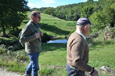
Montée du Moulin des Gaillards - Ardèche Hermitage Tourisme  Panorama
Viewing point
An enhancing landscape gradually comes into view revealing the Daronne valley and the old bridge down below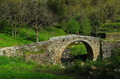
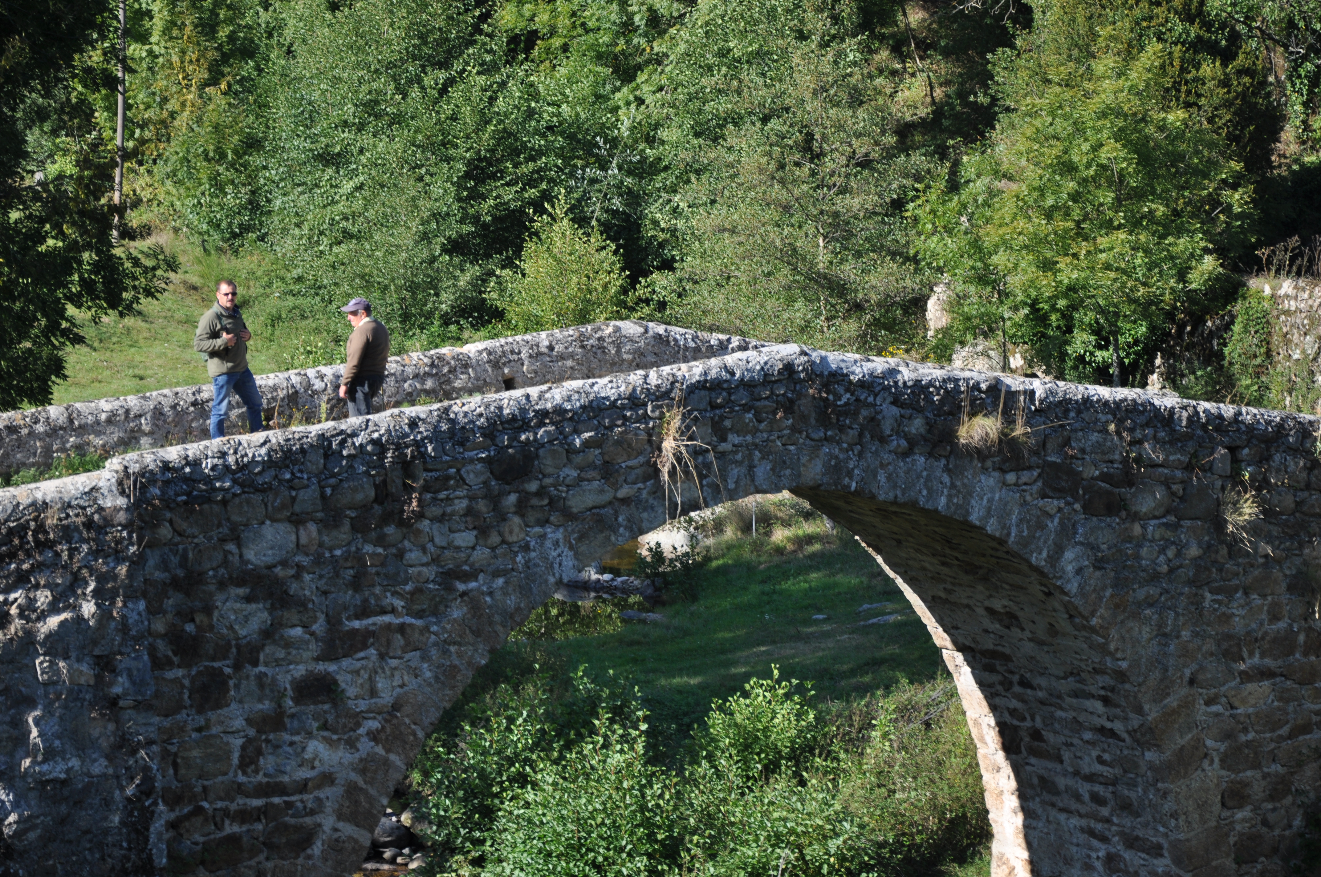
Pont au niveau du moulin - David Genestal - Carnet de Rando 
Gaillards Mill
Excellent evidence of how the Haut Vivarais is a geographically scattered housing region. Nature’s resources of have always been used in this area. The lack of wind forced people to use water. Water mills enabled the development of the earliest industries where wood was cut and grain and chestnuts were ground. Also called the bread tree, the chestnut tree prevented the county of Ardèche from famine on many occasions due to the high content in protein of its fruit. It is said that the life of the people of Ardèche is closely linked to that of the chestnut tree in many ways. Babies were rocked in cradles made from chestnut wood, chestnut leaves were used to feed cattle when fodder was lacking, its fruit was a main food, its wood was used for burning and people were buried in chestnut coffins. Quite a lovely story don’t you think ? Panorama
Viewing point
Viewing point overlooking the meandering Doux river.- Panorama
Viewing point
Splendid view of the Daronne Valley 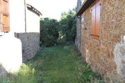
Passage entre les bâtiments - Ardèche Hermitage Tourisme Saint Félicien's silk farm
The link between silkworm breeding and the county of Ardèche dates back to the XVlth century when Olivier de Serre, father of present day agronomy and also personal advisor of Henri fully gave his support and encouragement for this activity. The moth of the Bombyx caterpillar has the particularity of secreting a filament that becomes silk when it solidifies. « Magnanerie » is the French name given to the silk farm where silkworms are cultivated. The name comes from the word « magnans », meaning big eaters. Silkworms are often called by this name due to their enormous appetite when given fresh mulberry leaves.
Description
1 - Saint Félicien - 535 m Follow Vaudevant 3 km Pailharès 7.9 km
Go up the narrow streets of Saint Félicien.
2 - Le Parc Follow Moulin des Gaillards 2.6 km Vaudevant 2.8 km
Take the small lane along the cemetery.
3 - La Simonde - 570 m Follow Moulin des Gaillards 2.4 km
Continue ahead on the small road.
4 - Chemin de la Congerie - 610 m Follow Moulin des Gaillards 2.3 km
Go up the track then down again into woodland and cedar trees leading to the main road. Turn left then immediately right and head down towards the place called Châtelas.
5 - Châtelas - 550 m Follow Moulin des Gaillards 1.3 km Saint Félicien 7.2 km
Follow a downhill track taking you to the route de Pailharès. Turn left onto the road and with caution continue as far as the transformer where you turn right . Go along the farm on the right then follow the small track to the road which will take you down to Moulin des Gaillards, facing the valley of the river Daronne.
6 - Moulin des Gaillards - 456 m Follow Malaurier 4.6 km Bozas 7.6 km
Go up into the woods with the river on your left. Pass the hamlet Gaillards then turn left and follow the country path. Make sure you take the path furthest to the left that goes down overlooking the valley of the Daronne river. Pass the glen and just before the entrance to the field take the track going along and above the fencing. Go slightly uphill into the wood then go back down to the hamlet Raillon.
7 - Raillon - 458 m Follow Pierrageay 1.4 km Bozas 6.4 km
Follow the road leaving the hamlet then at the following crossroads turn left onto the road downhill. Once on the main road turn right and go a few metres.
8 - Pierrageay - 405 m Follow Saint Félicien 2.3 km
After the bridge, liable to flooding, turn right and go along the river.
9 - Brintenas - 420m Follow Saint Félicien 1.8 km
Go up the small lane, cross a little stream then turn right onto a path going up to Saint Félicien. When you get to the road turn right then left and continue ahead back to the centre of the village.
- Departure : Saint Félicien - Post office car park
- Arrival : Saint Félicien - Post office car park
- Towns crossed : Saint-Félicien and Saint-Victor
Altimetric profile
Information desks

6, place du 8 mai 1945 - BP 70019, 26601 Tain l'Hermitage
Transport
Bus route N° 11 Tournon sur Rhône - Saint Félicien - Lalouvesc
Access and parking
Follow the D238 from Tournon sur Rhône then the D532 to Saint Félicien.
Parking :
Post office car park
More information
Report a problem or an error
If you have found an error on this page or if you have noticed any problems during your hike, please report them to us here: