Journey down to Saint Régis
Lalouvesc
Journey down to Saint Régis
2h
34,4km
+229m
-1181m
Embed this item to access it offline
3 points of interest
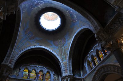
Choeur de la basilique - Ardèche Hermitage Tourisme 
Saint Régis in Lalouvesc
Reviving catholic faith in people from the hilly regions of Vivarais, Velay and Cevennes was the mission given to Saint Jean François Régis ! Ordained as a priest in 1630 and a missionary in 1632, this tireless walker used to cover 40 to 60 kilometres of ground every day. On 23rd December 1640, in a snowstorm, he left for what was to be his last mission in the North of the Vivarais region. He fell ill on the way and in spite of his high fever, he continued to pray and hear confession up to his last breath. On 31st December 1640 « God’s pilgrim » died in Lalouvesc at the age of 43. He received beatification in 1716 from the Pope Clément Xl and was canonized later on in 1737. Following that, Lalouvesc became a place of pilgrimage and a basilica was built in his name. Its building took 12 years to finish. The Basilica has two belltowers taken from two old churches. The final basilica was consecrated on 5th August 1877 by cardinal Guibert who was archbishop of Paris. The religious building houses relicas of the Saint and the stained glass windows present a visual review of his life. On the occasion of big events the tenor bell rings and can be heard for kilometres around. Information source : Topoguide "Le Chemin de Saint Régis" du Puy en Velay à Lalouvesc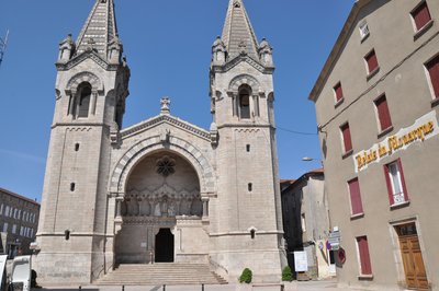
Portail de la basilique - Ardèche Hermitage Tourisme 
 Geology
Description
From the village, follow the D532 signed up Saint-Félicien to Col du Marchand.
1. 4,9 km Fork left to Satillieu.
2. 13,4 km Go through the village heading towards Saint-Alban-d’Ay.
3. 15 km Follow directions to Ardoix and go into the village.
4. 25,2 km On leaving the village turn left at the roundabout signed up Cormes and follow the main axe going down to the Rhône Valley.
5. 33 km Turn left onto the D86 leading into Sarras.
6. 33,7 km Turn left and head towards Saint-Vallier.
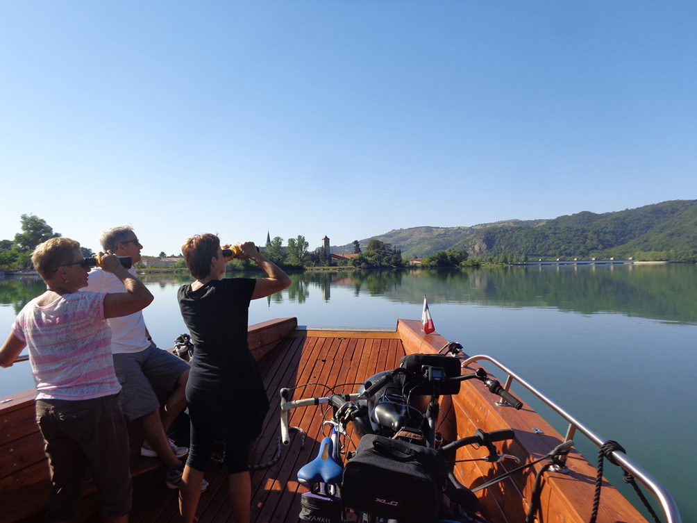
7. 34,5 km Just before crossing the river Rhône, follow the ViaRhôna on the right returning to Tournon if you choose not to use the boat journey.
1. 4,9 km Fork left to Satillieu.
2. 13,4 km Go through the village heading towards Saint-Alban-d’Ay.
3. 15 km Follow directions to Ardoix and go into the village.
4. 25,2 km On leaving the village turn left at the roundabout signed up Cormes and follow the main axe going down to the Rhône Valley.
5. 33 km Turn left onto the D86 leading into Sarras.
6. 33,7 km Turn left and head towards Saint-Vallier.
7. 34,5 km Just before crossing the river Rhône, follow the ViaRhôna on the right returning to Tournon if you choose not to use the boat journey.
- Departure : Lalouvesc – Center of the village
- Arrival : Sarras – Vivarais Avenue
- Towns crossed : Lalouvesc, Pailharès, Vaudevant, and Sarras
Altimetric profile
Information desks

6, place du 8 mai 1945 - BP 70019, 26601 Tain l'Hermitage
Access and parking
Parking :
Center of the village
More information
Report a problem or an error
If you have found an error on this page or if you have noticed any problems during your hike, please report them to us here: