The valley of Isère
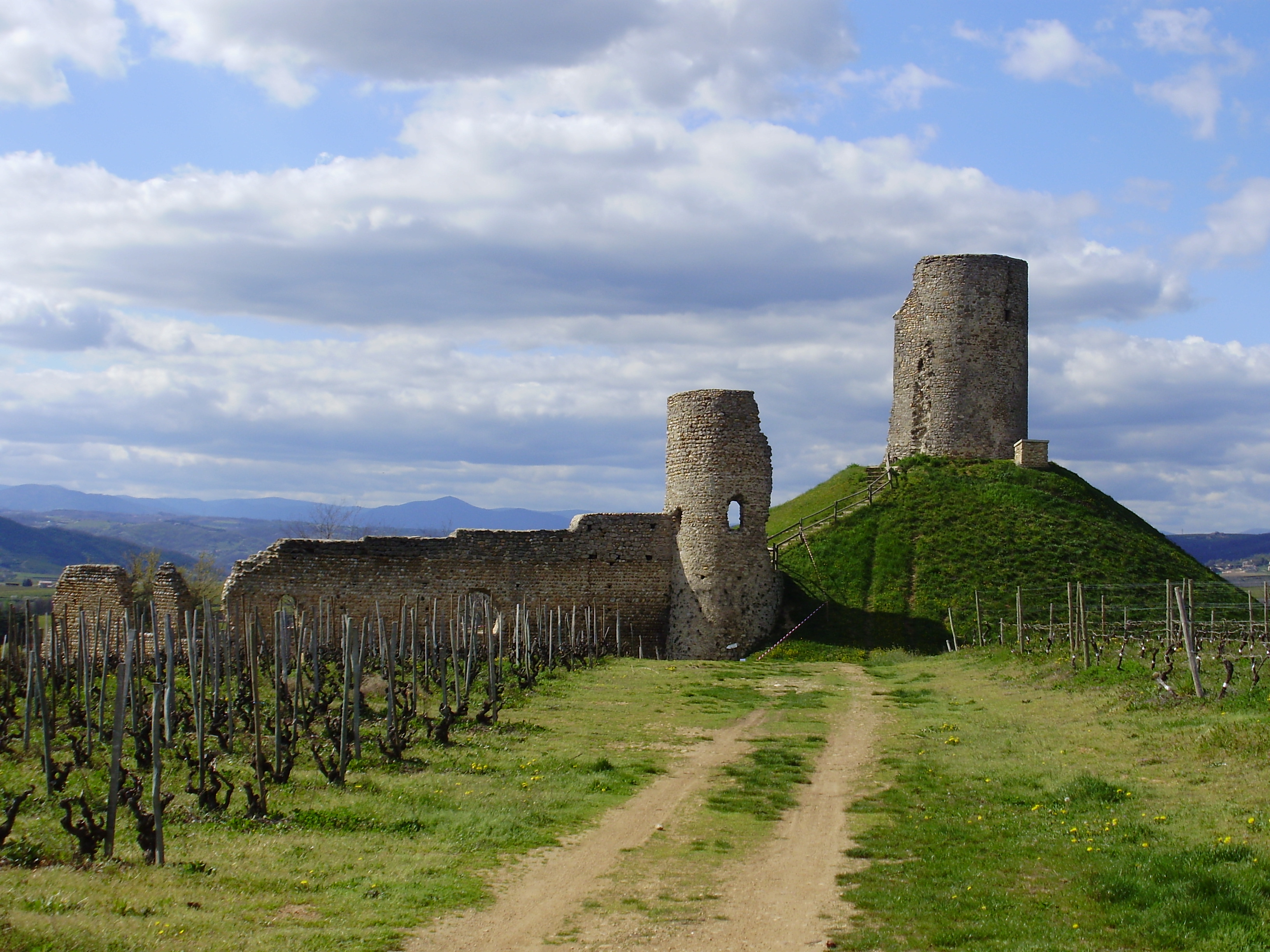
Beaumont-Monteux
The valley of Isère
4h
54,7km
+459m
-460m
Embed this item to access it offline
3 points of interest
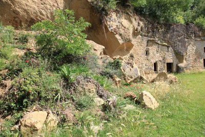
Habitat troglodyte - C. Fougeirol  Geology


Description
Head north towards “Domaine Breyton” for 900m then follow the sign to Chanos Curson.
1. 1,9 km Turn left onto “chemin de Compostelle”.
2. 3,2 km Turn right at the giveway sign then continue opposite at the following stop sign onto “chemin des Littes” to the centre of Chanos.
3. 5,4 km Turn left onto “route du Riou” continue for 400m then turn right onto “chemin de Veaunes and immediately left “chemin des Odouards”.
4. 6,6 km Turn right onto “route des Pends” to Mercurol.
5. 8,5 km Follow the D115 towards Veaunes.
6. 10,8 km Turn left onto “route des charmes”.
7. 11,4 km Turn right at the stop sign after the church then left onto “rue de l’eau vive” then left agein.
8. 12,1 km Turn right onto “route des sources”.
9. 13,3 km Turn right onto “route des vignes de la cure” then first left onto “route du Mont-Laurent”.
10. 15,3 km Turn left at the stop sign, immediately left onto “rue du côteau” then left again at the following stop sign onto “rue des pierres”.
11. 16,1 km Turn left at the stop sign onto “route de Romans” then follow the signs Châteauneuf-sur-Isère at the roundabout.
12. 17,8 km Turn left onto “chemin de la plaine”.
13. 18,7 km Turn left at the 2 giveway signs.
14. 19,7 km Straight on at the giveway sign following signs for Saint-Jean then turn left onto “route des collines”.
15. 21,1 km Turn right at the stop sign onto “route de Romans” then at the roundabout straight on “route des champs”.
16. 23,3 km Turn right onto “route des pierres”.
17. 24,3 km Turn right onto “route du barrage” then follow the Vallée de l’Isère cycling route heading west to Pontde- l’Isère.
18. 38,2 km Follow the ViaRhôna towards Tain.
19. 39,6 km Leave the ViaRhôna turning right onto a path through the woods.
20. 40,7 km Turn right at the stop sign then straight on at the roundabout.
21. 41,5 km Turn right towards Les Gours.
22. 43,3 km Turn left towards the “quartier “les pibouleries” then first left and first right.
23. 44,3 km Turn right at the giveway sign.
24. 45,7 km Turn left onto the Via Magne.
25. 46,2 km Go opposite onto the main road towards Tain.
26. 49 km Turn right onto “ch. de Chapon”.
27. 50,1 km Turn right at the stop sign then straight on at the following 2.
28. 52,2 km Turn right at the giveway sign then immediately left towards Chasselières then straight on to Beaumont-Monteux (don’t follow signs to Chassellières after left turn).
- Departure : Beaumont Monteux – Church
- Arrival : Beaumont Monteux – Church
- Towns crossed : Beaumont-Monteux, Chanos-Curson, Mercurol-Veaunes, La Roche-de-Glun, and Pont-de-l'Isère
Altimetric profile
Information desks

6, place du 8 mai 1945 - BP 70019, 26601 Tain l'Hermitage
Access and parking
Parking :
Church
More information
Report a problem or an error
If you have found an error on this page or if you have noticed any problems during your hike, please report them to us here: