Mountain pass route
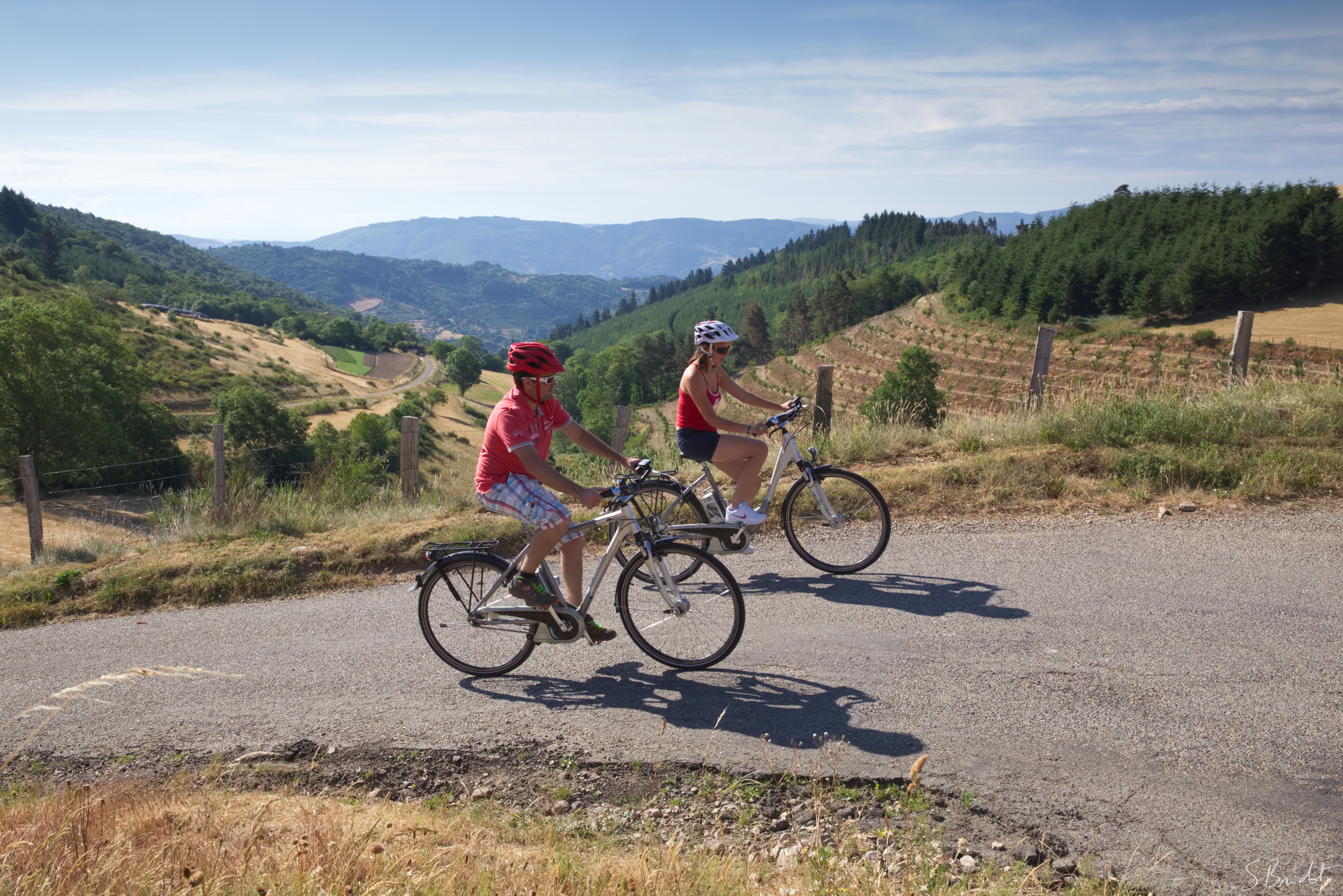
Pailharès
Mountain pass route
5h
75,8km
+1895m
-1902m
Embed this item to access it offline
9 points of interest
Vue du Col du Juvenet - Ardèche Hermitage Tourisme  Panorama
Viewing point
Col de Juvenet viewing point
 Small patrimony
Stone Masks
As you go past the church in Vaudevant glance at the apse to see its joyful little devil pulling his tongue out, seeming to make fun of you. Other enigmatic masks of this kind decorate walls of houses in the village and the whole of the area around Saint Félicien. Very often you find them on the outer walls of churches, on rich dwellings, on mission crosses or simply on walls of homes in the country villages. Of all ages and forms their presence remains rather mysterious and leads to various explanations…… even the most far-fetched ones. For fun, whimsical ideas of stone cutters, religious beliefs and superstitions dating back to our celt ancestors, symbols of protection… What do these human faces truly represent, peering at us with such distinctive expressions? Why not just let your imagination run riot. Information source : Le chemin des masques, région de Saint Félicien, association Histoire et Patrimoine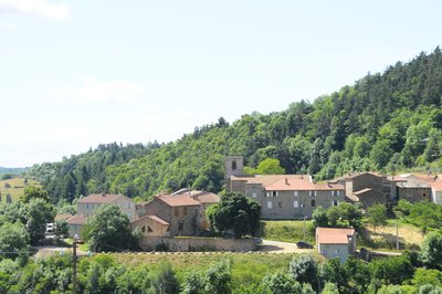
Vue d'ensemble du village - Ardèche Hermitage Tourisme 
Vaudevant
Mention of the village was already found during the Xlllth century. Its name would originate from « Val des Vents », « les Avents » (referring to wind) being a small hamlet situated at the top of the village. In 1090, the village became part of the town of St Félicien and joined the canons of St Barnard chapter (Romans sur Isère). However, following long negociations the village regained its autonomy in 1790.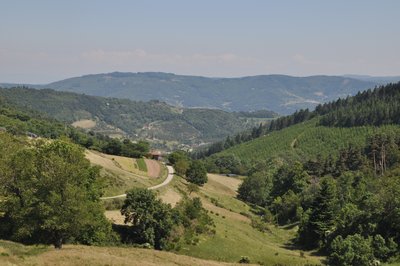
Panorama du Col de Fontfreyde - Ardèche Hermitage Tourisme PanoramaViewing point
Col de Fontfreyde viewing point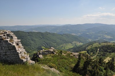
Point de vue des ruines - Ardèche Hermitage Tourisme 
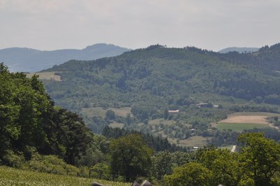
Vue sur la vallée du Doux - Ardèche Hermitage Tourisme PanoramaViewing point
Splendid view overlooking the Doux Valley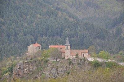
Village perché de Lafarre - Ardèche Hermitage Tourisme Small patrimony0- Panorama
Viewing point
Splendid view overlooking the village of Lafarre. Above, just behind the ridge, you can see the peak of the Mont Mezenc 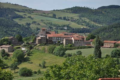
Vue du village - Ardèche Hermitage Tourisme Pailharès
Pailharès was no doubt a fortified stronghold as from the Roman era. During the Carolingian period the village covered a much greater area, the border lines of which are somewhat difficult to define today. In the article about the commandery of the Antonins of Aubenas, Doctor Francus (alias Albin Mazon) mentions a commandery of « Pailharès » being part of the commandery of Aubenas. Pailharès became an enclave of Forez in 1296. The village became part of the Vivarais region during the French Revolution. In 2003 it suffered a lot of damage after a forest fire caused by lightening on the Sardier hillside. Information source : Wikipédia
Description
Follow the small road signed up col du Marchand just right of the one going to col du Buisson and continue to col du Marchand.
1. 5,4 km Arriving at col du Marchand follow signs to Satillieu and continue to the village.
2. 14 km In the village turn right onto the D115 signed up Préaux.
3. 19 km Continue straight on on the D115 leaving the signs to Préaux on your left behind you.
4. 21 km Head towards Vaudevant keeping on the D115 to the village.
5. 26 km In the village turn right onto the small road, go past the church and as you leave the village, up towards col du Gibet past the cemetery. No directions given there.
6. 27,7 km At the T junction “Col du Gibet” turn right and join the main road, following it on the left side, down to Saint Félicien.
7. 27,9 km At the main road, turn left and go down to Saint-Félicien.
8. 31,6 km Follow directions to Nozières and Pailharès.
9. 36 km Go 4km, turn left onto a small road signed up Royer, le Flachet, Priolat, Les prés, Taverne, La Côte Gomaure, L’Homme, Le Bosc and Le Moulinet.
10. 39 km Carry straight on ignoring the signs on each side. Go past Le Moulinet then straight on to the col de Fontfreyde. At the following crossroads, turn right and straight on towards Fontfreyde and Villeneuve.
11. 41,6 km At the junction after Fontfreyde turn right. At the pass go straight on to Nozières.
12. 46,5 km In Nozières turn right at the church corner, onto the main road signed up Lalouvesc and continue to Col du Buisson.
13. 52,5 km Once at the pass turn onto the small road C6 leading to Molières and go as far as the village.
14. 56,2 km As you enter the village turn right signed up Le Doux.
15. 57,6 km Go past Tête and carry straight on, then right at the following crossroads onto the CD336 towards Lafarre and go as far as the village.
16. 62,5 km From the village, go straight up the main road, through the village continue straight on.
17. 66,7 km At the crossroads where the D236 and D336 join up turn left signed up Lalouvesc.
18. 68,7 km Go over the Col du Faux then turn right towards Saint-Félicien then downhill to the Col du Marchand.
1. 70,7 km At the Col du Marchand turn right towards Pailharès and return on the same road where you started from.
- Departure : Pailharès – Fountain square
- Arrival : Pailharès – Fountain square
- Towns crossed : Pailharès, Vaudevant, and Saint-Félicien
Altimetric profile
Information desks

6, place du 8 mai 1945 - BP 70019, 26601 Tain l'Hermitage
Access and parking
Parking :
Fountain square
More information
Report a problem or an error
If you have found an error on this page or if you have noticed any problems during your hike, please report them to us here: