Between orchards and vineyards
6 points of interest

 Flora
FloraGranite and its flora
Between the towns of Crozes Hermitage and Gervans granitic soils, renowned for their vineyards, are a geological continuity of the Massif Central region. Various succulent plants grow on the arid bluffs whilst others like fescues, box trees, blackthorn prefer the grassy slopes. Woody bushes, sage-leaved rockrose and heather make an edging to the woodlands of white oak trees.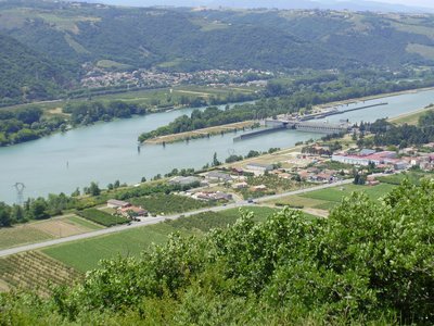
Belvédère des Méjeans - Ardèche Hermitage Tourisme  Panorama
Méjeans viewing point
Méjeans viewing point
 Small patrimony
- Flora
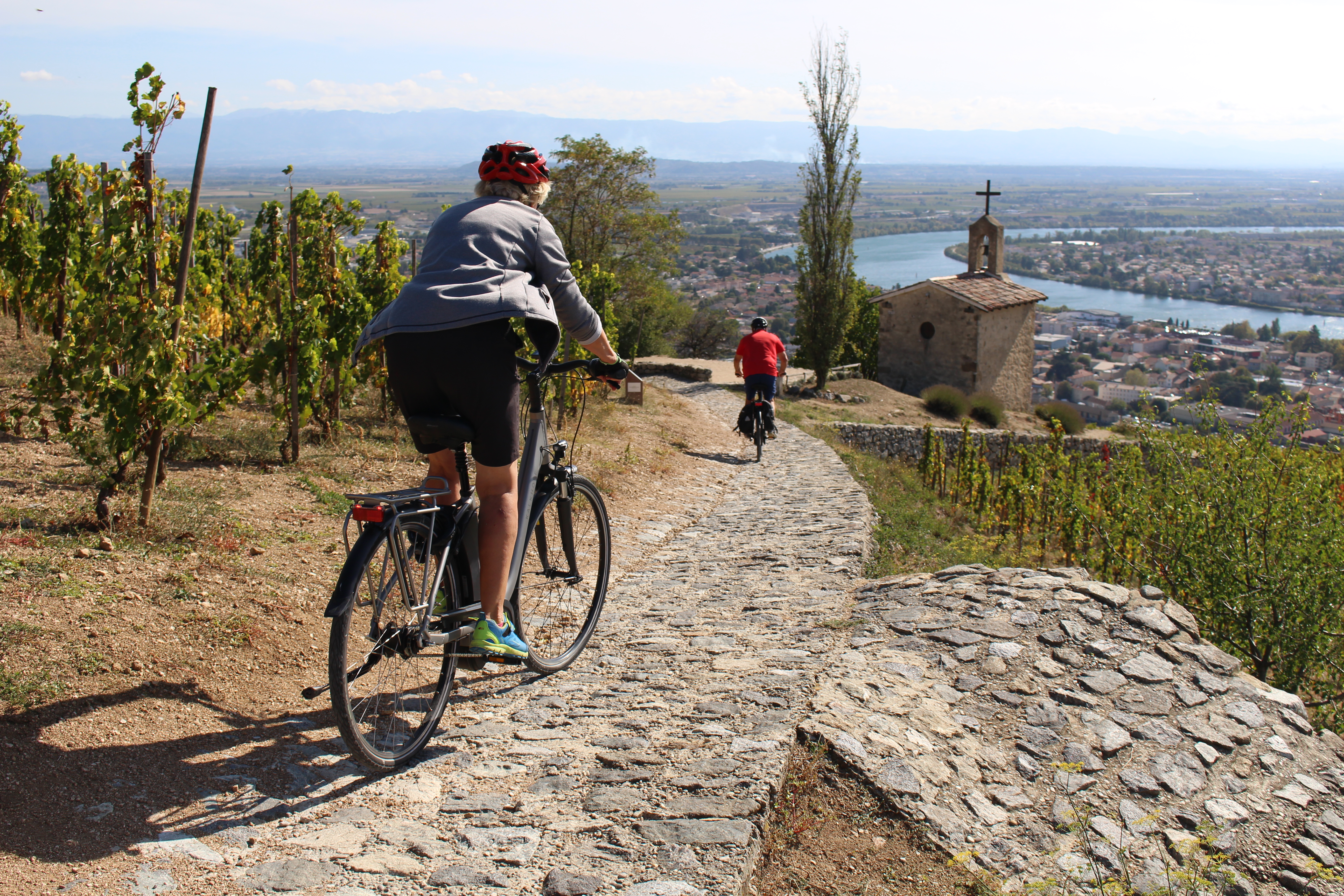
Tain l'Hermitage vineyards
The Hermitage slopes are the symbol of Rhodanien landscapes and are part of the most beautiful wine-growing areas in the region. At the heart of the northern Côtes du Rhône vineyards, this site was classified in 2013. Covering all the southern facing hillsides and offering an interesting, historical and beautiful landscape all add to making this great vineyard a good visual reference. The King's table
This rock standing in the middle of the river Rhône doesn’t have just any name ! It is said that in 1248, Saint Louis on his way to the crusades, stopped here for an unintended quick bite to eat in the shade of the grape vines on the Hermitage hillsides.
Description
From the townhall square go towards the school then follow the sign to “route des belvédères”.
1. 3,3 km Turn right at “les Planards”, continue to the “belvedere des Méjeans”.
2. 1.8 km Retrace your steps and head for the “belvedere de Pierre Aiguille”.
3. 16,3 km Head for Hermitage chapel.
4. 17 km Walk down the pebbled path below the chapel then turn left onto the side-path further on becoming a road.
5. 18,1 km Keep turning right following directions to Tain l’Hermitage on the D241.
6. 20,6 km Head to the Tourist Office.
7. 21,1 km Continue on the edge of the Rhône river and cross the footbridge ”Marc Séguin”. On the other bank turn right onto the ViaRhôna heading north towards Arras-sur-Rhône.
8. 32,1 km Turn right onto the D800.
9. 36 km Turn left straight after thedam.
10. 37,1 km Turn right onto “route Saint-Antoine”.
11. 37,4 km Cross the N7, go over the railway line then turn right to Gervans.
- Departure : Gervans – Townhall square
- Arrival : Gervans – Townhall square
- Towns crossed : Gervans, Érôme, Crozes-Hermitage, Larnage, Tain-l'Hermitage, Tournon-sur-Rhône, Saint-Jean-de-Muzols, Lemps, Vion, and Serves-sur-Rhône
Altimetric profile
Information desks

6, place du 8 mai 1945 - BP 70019, 26601 Tain l'Hermitage
Access and parking
Parking :
More information
Report a problem or an error
If you have found an error on this page or if you have noticed any problems during your hike, please report them to us here: