The Rhône with its balconies and tributaries
Cheminas
The Rhône with its balconies and tributaries
Very hard
8h
124,3km
+0m
0m
Embed this item to access it offline
6 points of interest


Grand Pont
The building of this majestic bridge called the « Grand Pont », began around year 1380. Its construction was by no means easy ; the scaffolding was regularly carried away by floods of the river Doux lower down which is one of the reasons why a semi-arched architecture was chosen. Classified amongst historical monuments in 1954 the bridge has become part of everyday life for the local people who show a certain devotion towards it. Panorama
Viewing point
Beautiful views overlooking the Rhône Valley, the Alps mountain range and the Mont Blanc- Panorama
Viewing point
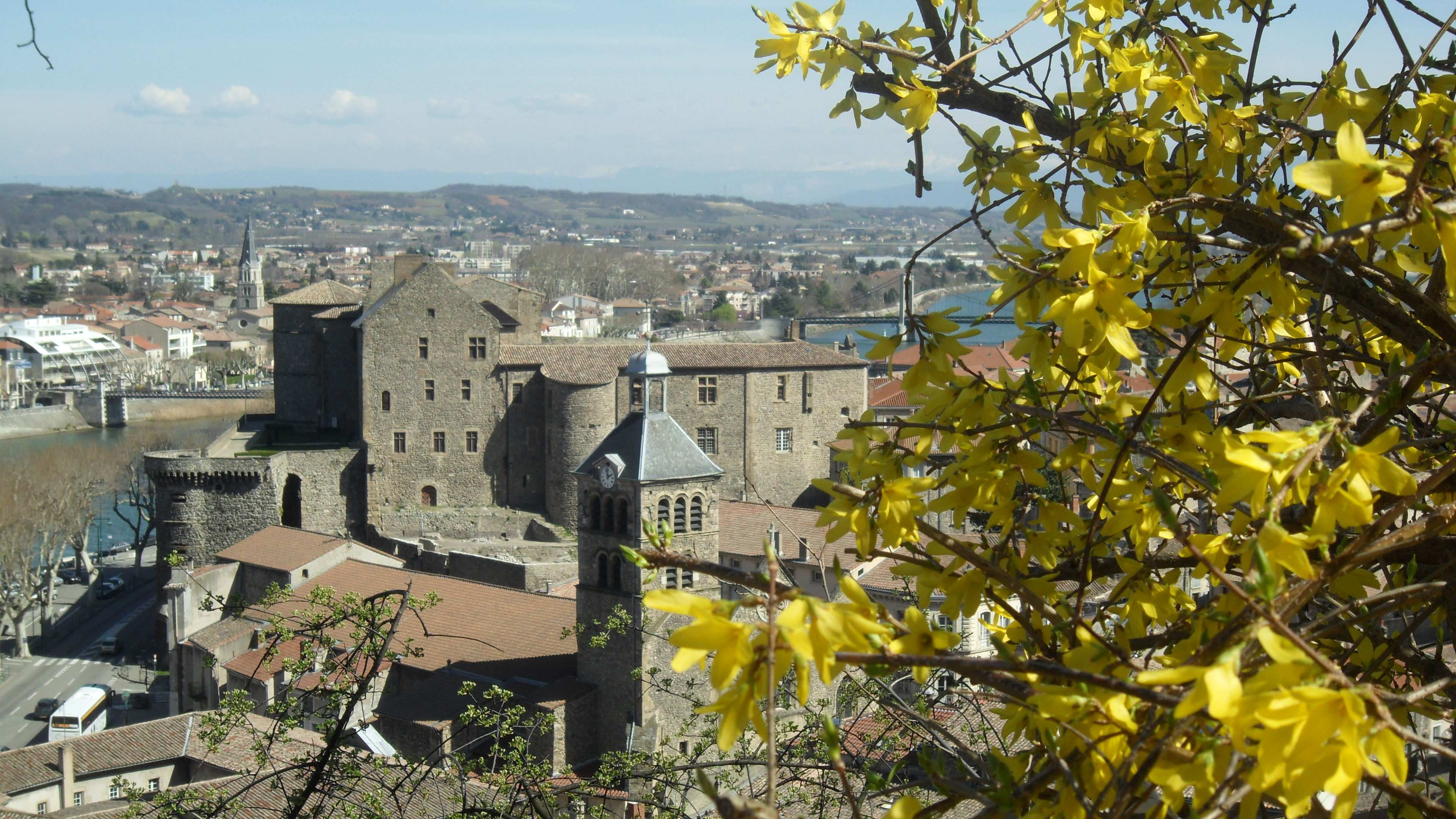
Splendid views of the town of Tournon sur Rhône and the Rhône Valley below with the Vercors and Alps mountain range in the distance. - Panorama
Viewing point
Splendid view of the town of Tournon sur Rhône 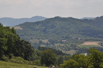
Vue du Col du Juvenet - Ardèche Hermitage Tourisme PanoramaViewing point
Col de Juvenet viewing point- Panorama
Viewing point
View of the village of Saint Victor
Description
Go onto the route de Tournon sur Rhône.
1 – 1.5 km
Go over the bridge and turn first left after the road sign (black cross on a white triangle) indicating give way to the right. Start the climb up towards col de Fontaille.
2 – 2.9 km
Once on the main road continue ahead to the left, over the col de Fontaille and then straight on.
3 - 6 km
Go through Saint Victor and continue along the main road towards Tournon sur Rhône
4 – 11.5 km
Just before la Croix de Fraysse and the sign towards Sècheras and Cheminas turn right onto the route de Réal.
5 – 11.7 km
Go as far as Etables
6 – 13.8 km
Turn left at the stop sign to leave the village
7 – 14.5 km
Turn right just after the bridge onto the route de Chère and carry on ahead.
8 – 16.1 km
Turn right back onto the main road.
9 – 17.9 km
Take the small road on the right with a 30-km per hour speed limit just after the white cross on the wide left bend.
10 - 19 km
Turn right onto the main road at the stop sign.
11 – 20.8 km
Go past l’Ubac and straight on.
12 - 25 km
Just after crossing the river turn right onto the D534 at the stop sign towards Colombier le Vieux.
13 – 26.4 km
Just after the bridge over the river Duzon turn left and go as far as Barthélémy le Plain.
14 – 30.6 km
Pass Saint Barthélémy le Plain and continue ahead to Colombier le jeune.
15 – 37.6 km
In the village turn left onto the rue des Balcons opposite the bakery and on the corner of the restaurant L’Elissor.
16 – 37.7 km
Go towards the signs for Ecole Publique, Ecole Privée, Médecin, Infirmière
17 – 37.8 km
Go past the school and continue ahead.
18 – 38.2 km
Below the village, at the crossroads les quatre routes, turn 2nd right to the left of the road leading towards les Morfins, Fond de la Pose, La Belle.
19 – 39.8 km
At the following crossroads head for Ferme de Cartara and straight on towards Plats.
20 – 45.2 km
Turn left just before the village at the crossroads Combemale.
21 – 47.2 km
Go through the village then right before the signpost, indicating leaving the village, towards Simondon, Balayon.
22 – 47.6 km
When you reach Lespirilles, turn left towards La Grange, Les Chevaliers then go straight on.
23 – 48.6 km
Pass Les Chevaliers and continue ahead.
24 – 50.7 km
Then follow the signs to Mauves on the small road closed in the case of snowfall or black-ice.
25 – 52.8 km
Just before Mauves, at the stop sign, turn right into the village.
26 – 53.6 km
In the village turn left then right immediately.
27 – 54.8 km
Carry on ahead at the following stop sign, left at the giveway then right at the first roundabout and finally left at the second roundabout taking you to the town centre of Tournon sur Rhône.
28 – 56.7 km
Carry on ahead to the traffic lights then turn left.
29 – 58.3 km
Go as far as Saint Jean de Muzols.
30 – 59.8 km
Go through the town and continue straight on.
31 – 61.2 km Turn left towards Lemps.
32 – 61.8 km
Go uphill and turn first right up the steep incline.
33 - 67 km
Continue straight on then follow the signs to Lemps.
34 – 67.5 km
Go through Lemps and continue on the main road.
35 – 69.1 km
When you reach Bobon turn right heading towards Bert, Guillaumet, Gouyettes.
36 – 69.2 km
Then left immediately towards Cambalieu.
37 – 70.1 km
Turn first left as you go down.
38 – 70.4 km
Turn first right and carry straight on.
39 – 74.5 km
In the village of Vion turn left then right at the townhall square.
40 – 74.8 km
Turn left at the stop sign.
41 – 75.7 km
After the village turn left onto the D17 and go to Sécheras.
42 – 81.4 km
Turn right in the village in front of the statue and continue ahead.
43 – 82.5 km
Go as far as Arras.
44 – 86.7 km
In the village of Arras turn left just before the stop sign.
45 – 87.8 km
After going through the village, turn left at the stop sign and go to Sarras.
46 – 92.6 km
In Sarras turn left at the traffic lights towards Saint Félicien, Eclassan, Saint Jeure d’Ay then continue ahead out of the village, heading towards the plateau.
47 – 96.1 km
On a wide left bend turn right signed up Chalavouze, Buffet, Solémieux and continue along the main road.
48 – 97.2 km
Pass Champaron and Solémieux continuing straight on.
49 – 98.1 km
Get back onto the RD6.
50 – 98.7 km
Once on the D6 turn right and go past Les Bardons.
51 – 99.1 km
Turn left onto the D297 and head for Eclassan.
52 – 100.1 km
Go through the village and continue straight on.
53 – 100.6 km
Turn left heading for La Croix du Fraysse
54 – 100.7 km
Turn right at the giveway sign leaving Eclassan behind you.
55 – 100.8 km
Pass Les Blancs, Pacaud and continue straight on.
56 – 106.1 km
Once on the main road, just before la Croix de Fraysse, turn right without going into the hamlet and continue towards Saint Jeure d’Ay.
57 – 109.7 km
At the entrance to the village, go straight on at the roundabout into Saint Jeure d’Ay.
58 - 110 km
At the stop sign turn left then right immediately to start the uphill climb towards the col du Juvenet.
59 – 118.8 km
At the col du Juvenet turn left taking you down to Vaudevant.
60 – 121.5 km
Go through the village of Vaudevant and continue ahead back to Saint Félicien.
- Departure : Saint Félicien - Post office car park
- Arrival : Saint Félicien - Post office car park
- Towns crossed : Cheminas, Colombier-le-Jeune, Étables, Lemps, Mauves, Plats, Saint-Barthélemy-le-Plain, Saint-Félicien, Saint-Jean-de-Muzols, Saint-Victor, Sarras, Sécheras, Tournon-sur-Rhône, Vaudevant, and Vion
Information desks

6, place du 8 mai 1945 - BP 70019, 26601 Tain l'Hermitage
Transport
Bus route N° 11 Tournon sur Rhône - Saint Félicien - Lalouvesc
Access and parking
Follow the D238 from Tournon sur Rhône then the D532 to Saint Félicien.
Parking :
Post office car park
Accessibility
- Emergency number :
- 114
More information
Report a problem or an error
If you have found an error on this page or if you have noticed any problems during your hike, please report them to us here: