Tour du Pays de Saint Félicien - Stage 1 : Col du Marchand - Corsas
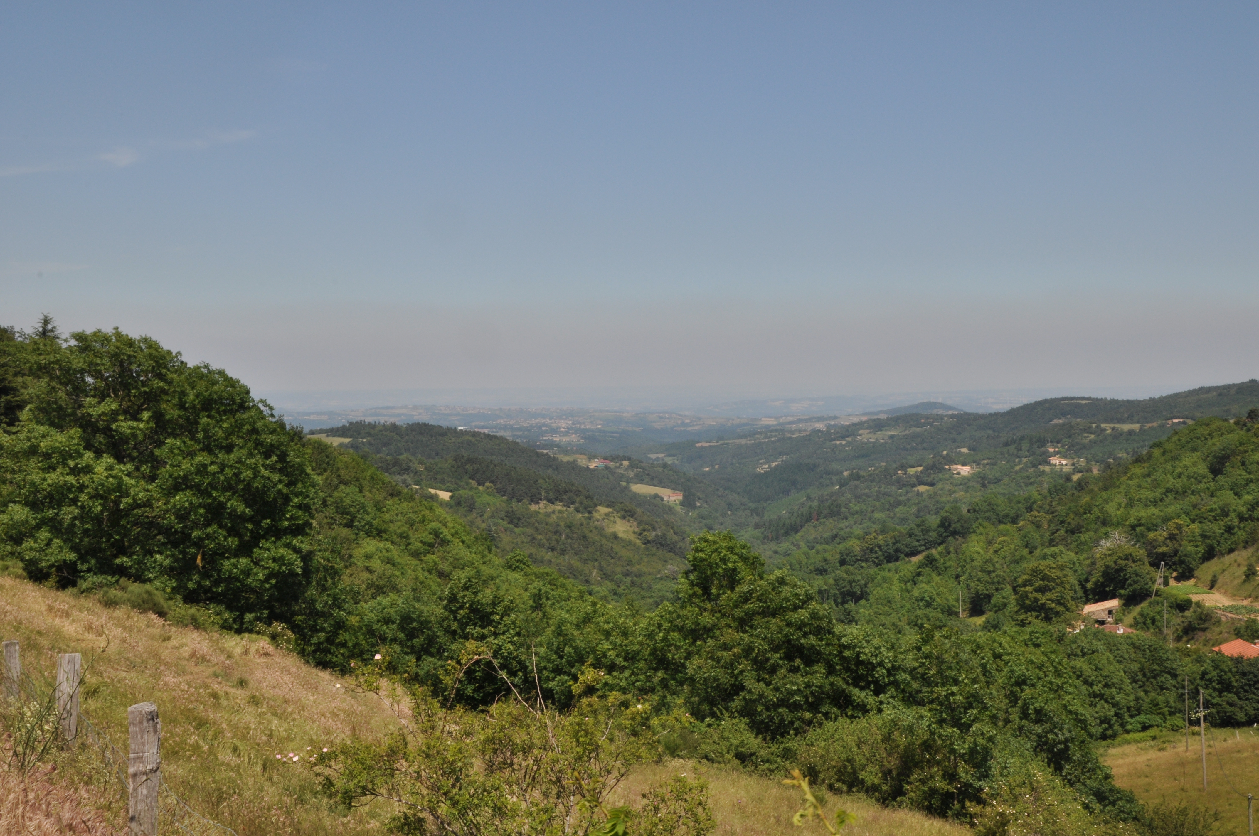
Vaudevant
Tour du Pays de Saint Félicien - Stage 1 : Col du Marchand - Corsas
Hard
7h
16,8km
+332m
-714m
Embed this item to access it offline
3 points of interest


The Afars
The Afars (kind of goblin) are shady, countryside characters. They live together as a family in natural hollows such as la grotte de la chèvre at la Roche Berne in Vaudevant. How do we recognize them ? The Afars are men and women smaller than humans, rather more the size of a child. They have pointed ears and their one eye in the middle of the forehead makes them look similar to a cyclops ! Most of the time they are without clothes but occasionally may wear leaves as covering. However, you will never see them during the day as they are nocturnal creatures. As soon as it’s dark, they come out to go scrumping. They pilfer vegetables in gardens along with linen and other objects. They milk the farmers’ cows to feed their children. On odd occasions one or two might get caught due to clumsiness caused by stolen boots and clogs much too big for them. They speak the Occitan dialect so convincingly that they never stay captured for very long as their captors always finish by feeling sorry for them and letting them go free ! Information source : Revue Lo Grinhon N°6 - 1990. Small patrimony
The cross of Montplot
Joannès Dufaud (parlarem en Vivarés edition 2004) describes it as a mountain of timber and wood stumps or quite simply a mountain where trees are logged and cut into ¾-metre lengths as in a wood yard. We can in fact observe here, that the way of working hasn’t changed much over the years. Information source : Ardèche Sports Nature.- Small patrimony
The terraces
In this area "Chalets" is the word used to describe terraces on slopes making them useable for various cultures. Most of the terraces were built in XVlllth and XlXth centuries. At that time, the population, 90% of which were farmers, was on an increase. Always looking for land to cultivate, quite simply to survive, the latter were forced to use the steep slopes. Vine growing was also on an increase during that same period and necessitated arable land. Building terraces was the answer; increasing surfaces for growing and at the same time making the slopes easier to use, enabling water retention and controlling it, keeping the soil from erosion and restoring the heat absorbed by the rock-stone during the day. Little by little the use of these "chalets" was abandoned due to various plant diseases at the end of the XlXth century, particularly Mildew and Phylloxera that destroyed whole vineyards and crippled farming. However, rural depopulation, the number of lives lost during the first World War and the mechanization of farming down in the lower plains were the main reasons for terraces being abandoned. As you stroll along you will discover a landscape shaped by these « farmer builders”. Here, amongst this stone architecture, traces are particularly visible, making it easy to imagine the magnitude of the task.
Description
1 – Col du Marchand – 903m Follow Pourchat 2.1km Satillieu 9.2km
Take the small road below on the right. At the fork turn right onto the uphill path and continue to Pourchat.
2 – 850m Follow Croix de Lionnet 4km Satillieu 7.1km
Follow the track on the left until you reach the Côte de Bruchet.
3 – La Côte du Bruchet – 890m Follow Vaudevant 6.9km
Carry on along the forest route where you can see various species of trees (birch, douglas pine, wild cherry, oak….) Occasionally gaps in the trees give you a glimpse of far-off landscapes.
4 – Le Grangeon – 770m Follow Montplot 3.7km Saint Victor 7.8km
Continue on the forest track on leaving Grangeon to join the GR42.
5 – Bois de Meyannes – 732m Follow Montplot 2.3km Saint Victor 6.4km
Continue on the signposted rambling trail (GR) Cross the D15 at the Col du Juvenet then continue opposite on the uphill path to Montplot.
6 – Montplot – 785m Follow Saint Victor 4.3km
Continue on the GR then turn left onto the downhill track. From here you overlook the village of Préaux and the town of Annonay. Turn right and follow the main track. The path goes through a hamlet in ruins. Further on take the road to the left.
7 – Gounon – 720m Follow Saint Victor 2km
Turn right and continue down on the GR.
8 – Les Bauds – 692m Follow Saint Victor 1.7km
Here go down the path and once at the road turn left.
9 – Chemin de Croix – 630m Follow Saint Victor 300m
Go into the village of Saint Victor.
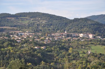
10 – Saint Victor – 610m Follow Deyras 4.9km Etables 5km
Follow the GR42 and leave the village past the cemetery. At the Croix des Rameaux follow the path on the left to the road at Le Besset. Follow this road. At the fork bear left. Pass La Thulière then go straight on. On the right a small uphill path goes into the wood.
11 – Laumache – 526m Follow Etables 3km
Turn right onto the small road to Corsas.
Take the small road below on the right. At the fork turn right onto the uphill path and continue to Pourchat.
2 – 850m Follow Croix de Lionnet 4km Satillieu 7.1km
Follow the track on the left until you reach the Côte de Bruchet.
3 – La Côte du Bruchet – 890m Follow Vaudevant 6.9km
Carry on along the forest route where you can see various species of trees (birch, douglas pine, wild cherry, oak….) Occasionally gaps in the trees give you a glimpse of far-off landscapes.
4 – Le Grangeon – 770m Follow Montplot 3.7km Saint Victor 7.8km
Continue on the forest track on leaving Grangeon to join the GR42.
5 – Bois de Meyannes – 732m Follow Montplot 2.3km Saint Victor 6.4km
Continue on the signposted rambling trail (GR) Cross the D15 at the Col du Juvenet then continue opposite on the uphill path to Montplot.
6 – Montplot – 785m Follow Saint Victor 4.3km
Continue on the GR then turn left onto the downhill track. From here you overlook the village of Préaux and the town of Annonay. Turn right and follow the main track. The path goes through a hamlet in ruins. Further on take the road to the left.
7 – Gounon – 720m Follow Saint Victor 2km
Turn right and continue down on the GR.
8 – Les Bauds – 692m Follow Saint Victor 1.7km
Here go down the path and once at the road turn left.
9 – Chemin de Croix – 630m Follow Saint Victor 300m
Go into the village of Saint Victor.
10 – Saint Victor – 610m Follow Deyras 4.9km Etables 5km
Follow the GR42 and leave the village past the cemetery. At the Croix des Rameaux follow the path on the left to the road at Le Besset. Follow this road. At the fork bear left. Pass La Thulière then go straight on. On the right a small uphill path goes into the wood.
11 – Laumache – 526m Follow Etables 3km
Turn right onto the small road to Corsas.
- Departure : Pailharès - Col du Marchand
- Arrival : Saint-Victor - Château de Corsas
- Towns crossed : Vaudevant and Saint-Victor
Altimetric profile
Information desks

6, place du 8 mai 1945 - BP 70019, 26601 Tain l'Hermitage
Transport
Bus N° 11 Tournon sur Rhône - Saint Félicien - Lalouvesc only during the summer
Access and parking
From Saint Félicien head towards Lalouvesc on the D532 stopping at the Col du Marchand
Parking :
Col du Marchand
More information
Report a problem or an error
If you have found an error on this page or if you have noticed any problems during your hike, please report them to us here: