From one ridge to the other
Colombier-le-Jeune
From one ridge to the other
Hard
5h30
15,4km
+509m
-507m
Embed this item to access it offline
5 points of interest

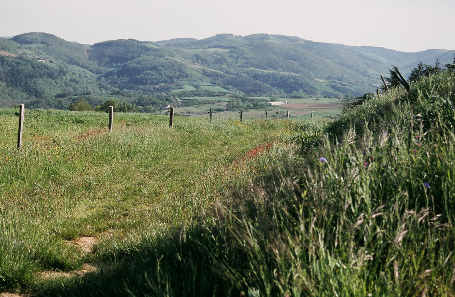
 Panorama
Viewing point
Beautiful views overlooking the Ormèze valley and the village of Colombier le Vieux- Panorama
Viewing point
Beautiful views overlooking the village of Plats with the Alps in the background - Panorama
Viewing point
Beautiful views overlooking the Doux valley to the left and the Ormèze valley to the right 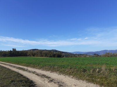
Point de vue sur la voie du doux en crête - ADSEA 
The Doux Trail
La Voie du Doux (the Doux Trail) is a very old celt cattle track that headed up the the Doux Valley via ridges and passes going from the Rhône Valley as far as the region of Auvergne. It was called "la voie des marchands" (sales merchants’ route) or "le chemin de la grande charrière" (the great cart route) perhaps no doubt because at some time it was used for transporting goods by cart. In the XVlllth century it was also called « the Way of the Cross » due to the number of crosses along the way. They were intended as protection for travellers but were also landmarks as the trail went mainly along the ridges. This avoided too many river crossings and was safer. In order to get round the peaks between two mountain passes, the trail more often followed the northern face more sheltered from the sun. It was not a wide obvious, regular track at that time as we might imagine, just a narrow path made by mans’ footprints taking the shortest distance with their pack mules. The state of the track could vary according to weather conditions and vegetation growth. The 6-team pack mules were used to transport different produce from the Rhône Valley and southern France (oil, salt, and later on wine) to the Velay and Auvergne region and returning with cereals and textile produced inland.The dolmen of Chabot
Brittany is not the only place where funeral monuments of the neolithic era can be found ! This one has the particularity of using a granitic block as its natural foundation. There are at least 800 dolmens in Ardèche making it one of the counties in France where the largest number can be found. Even though many of them have been subject to excavation campagnes a lot of them still have many secrets to reveal.
Description
Reach the centre of the village by the main road Cross the square and head opposite onto rue du Trappou leading to the church.
1 - Colombier le Jeune - 510 m Follow Le Serre 3.1 km Gilhoc sur Ormèze 4.5 km
Go past the front of the church and down the street la calade to the fountain square. Go onto the path opposite between two walls, called pont des amoureux then down to the river where you cross the lovely little bridge.
2 - Pont de Duron - 485 m Follow Le Serre 2.9 km Gilhoc sur Ormèze 6 km
Keep on the small road through meadow and cultures going down to Ormèze. After crossing the lovely bridge over the river, the road goes up towards the hamlet of Bosc. Turn right onto a path going through the hamlet then go up through a wood of chestnut and pine trees.
3 - Le Serre - 550 m Follow Saint Sylvestre 5 km
The path overlooks the glen of the stream Peyremaule then emerges into a grove of chestnut trees coming out at la Chapelle. Take the track going down facing the glen through orchards then woodland. When you get to the place called Bogiraud turn right immediately and follow the path along the hillside.
4 - Les Terres - 479 m Follow Turlet 2.3 km Colombier le Jeune 3.9 km
When you come to the small road go uphill then leaving it behind you when you reach a path going straight ahead.
5 - Issartier - 430 m Follow Turlet 1.1 km St Barthélémy le Plain 7.7 km
6 - Blenon - 428 m Follow Turlet 700 m St Barthélémy le Plain 7.3 km
Take the path emerging onto a small road. Turn left then immediately right onto the path going down into the woods and taking you to the river Ormèze. Careful when crossing the footbridge.
7 - Turlet - 380 m Follow Orion 3.2 km Boucieu le Roi 7.4 km
The small road follows the river Ormèze. At the crossroads turn right onto the steep incline. The path becomes narrower and takes you into an oak tree grove then crosses a stream before going up through pine and chestnut trees. Come out of the wood and follow the path until you get to
- Departure : Colombier le Jeune - Townhall square
- Arrival : Colombier le Jeune - Townhall square
- Towns crossed : Colombier-le-Jeune and Boucieu-le-Roi
Altimetric profile
Information desks

6, place du 8 mai 1945 - BP 70019, 26601 Tain l'Hermitage
Transport
Bus route N°7 Tournon sur Rhône - Lamastre - Saint Agrèe - Le Chambon sur Lignon
Access and parking
Follow the D234 from Tournon sur Rhône towards Lamastre then the D238 to Saint Barthélémy le Plain then on to Colombier le Jeune.
Parking :
Townhall square
More information
Report a problem or an error
If you have found an error on this page or if you have noticed any problems during your hike, please report them to us here: