
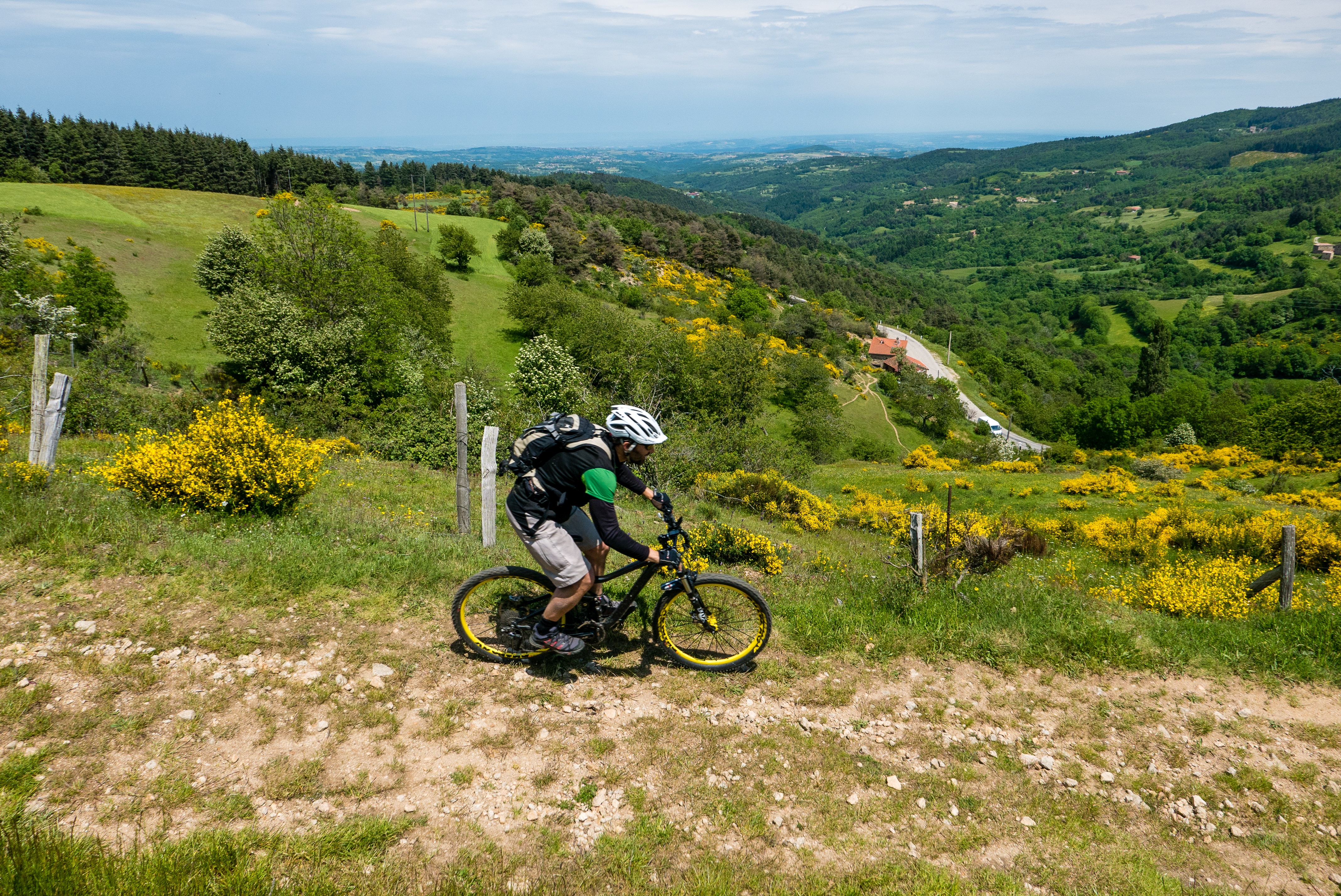
Grande Traversée VTT de l'Ardèche : Tronçon Saint Félicien - Saint Agrève
Tournon-sur-Rhône
Grande Traversée VTT de l'Ardèche : Tronçon Saint Félicien - Saint Agrève
Very hard
12h
117,7km
+3972m
-3033m
Embed this item to access it offline
26 points of interest


The King's table
This rock standing in the middle of the river Rhône doesn’t have just any name ! It is said that in 1248, Saint Louis on his way to the crusades, stopped here for an unintended quick bite to eat in the shade of the grape vines on the Hermitage hillsides. Panorama
Viewing point
Facing you take a look at the Montbard hill and its quarry with the Pilat mountains in the background- Panorama
Viewing point
To your left you can see the village of Sécheras and in the background, on a clear day the Vercors mountain range. A little further on, facing you, notice the church of Cheminas - Panorama
Viewing point
Views of the Montbard hill in the foreground and the town of Annonay and the Pilat mountains further back The chapel in Ceintres
Church of one of the old parishes that Cheminas is part of today, it was a stopping place of worship for pilgrims as from the Xlth century. Closeby is the lake of Meinettes a hillside reservoir for the irrigation of surrounding farming land. The richness of the soil in the Ardèche hills is ideal for cereal farming and the top plateau has become a genuine breadbasket. However, the cracks in the granitic rock swallowed the rainwater before it had time to be absorbed by the ground so a way to retain this water became necessary hence the construction of the lake. Don’t miss a walk round the latter with information boards telling you all about the fauna and flora of the area.- Panorama
Viewing point
Beautiful view overlooking the Doux Valley 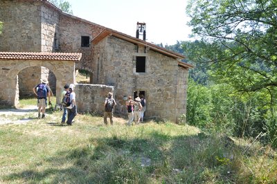
Vue d'ensemble du hameau - Ardèche Hermitage Tourisme The chapel of Sorny
Careful ! You are on private property. The kind owners however allow access so please show respect and leave the place as you found it. Nestled on a curve of the river Daronne, welcome to Saint Sorny a small gem dating back to Xlllth century, with its chapel being the only place open to visit. On Easter Monday a pilgrimage has always taken place every year since 1673. At that time two yearly masses were held in the chapel to help cover its costs. One was on Easter Monday and the other for Saint Saturnin celebrated on 29th December. The latter was held with the hope of healing childrens’ headaches. Information source : Traces of history in the Daronne Gorges by Sylvette Sylvette Béraud-Williams and Christian Louis Astier, Publication by Ardèche verte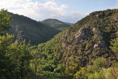
Point de vue au sommet de la colline derrière Saint Sorny - Ardèche Hermitage Tourisme  Fauna
FaunaThe secret nature of the Daronne Gorges
Only a few kilometres from the Rhône Valley discover the Daronne Gorges ; a secluded haven make it an exceptional site part of a zone recently labelled "Espace Naturel Sensible" (sensitive nature zone) by the county authorities. A walk full of surprises through this breathtaking, secretive valley being at the same time so close yet so remote. To make the most of this educational trail make sure you have the appropriate kit. So on with your walking boots ! Find details about the trail on site (kit can be purchased in our tourist offices).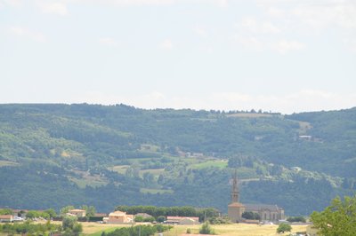
Village de Colombier le Vieux - Ardèche Hermitage Tourisme Colombier le Vieux
Bordered by the Daronne and Doux rivers’ gorges the village of Comombier le Vieux dominates the surrounding landscape. Other than its undeniable nature heritage, you will also find beautiful traces of lordship architecture dating back to XVlth century with the château de Bellecombe recently restored aliong with the fortified manor house of Ruissas. Colombier le Vieux was used to illustrate the book La Maison Rouge by Maurice Genevoix. The latter tells how the village was passed to the Huguenots and targeted by a troop paid by the catholics. A book to enjoy reading.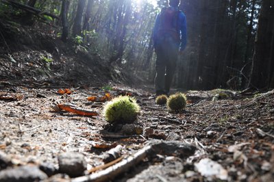
Voie antique de Malaurier - Ardèche Hermitage Tourisme Roman way of Malaurier
A stone-paved path out in the countryside…. Quite intriguing and it makes us wonder if these paving stones have experienced the walking steps of “caligae” (Roman legionnaires’ sandals) Rather difficult nowadays to confirm if that was the case. However, the oppidum above the village of St Symphorien de Mahun and the Roman bridge ruins in Boucieu le Roi and in Tournon sur Rhône make it quite possible for it to have been a communication route across the plains of Ardèche. At that time roads were built on the smoothest terrain to make travelling easier. An example of this is the route going from Lamastre to annonay. If you close your eyes you can hear Gauls singing in the distance and you might even find some mistletoe to add to your magic potion. Luckily we are aware today that the berries are poisonous !- Panorama
Viewing point
Splendid view of the Daronne Valley 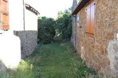
Passage entre les bâtiments - Ardèche Hermitage Tourisme Saint Félicien's silk farm
The link between silkworm breeding and the county of Ardèche dates back to the XVlth century when Olivier de Serre, father of present day agronomy and also personal advisor of Henri fully gave his support and encouragement for this activity. The moth of the Bombyx caterpillar has the particularity of secreting a filament that becomes silk when it solidifies. « Magnanerie » is the French name given to the silk farm where silkworms are cultivated. The name comes from the word « magnans », meaning big eaters. Silkworms are often called by this name due to their enormous appetite when given fresh mulberry leaves.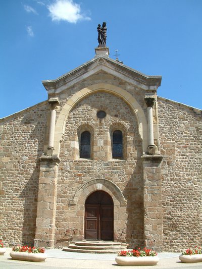
Eglise romane de Saint Félicien - Ardèche Hermitage Tourisme Saint Félicien and its church
Written records about the village of St Félicien were discovered as from the Xth century. Monks from St Barnard’s collegiate (Romans sur Isère) came here to build a priory. The village developed round the chapel of the priory that then became the parish church. Push the door to discover its interior. The choir is a good example of early Roman art of the Xlth century. The low southern side was partly destroyed and rebuilt towards the end of the Middle Ages. The style is more sober with broken bows.- Panorama
Viewing point
As you go down look to your right to see a splendid view of the village of Pailharès situated above the river Daronne. 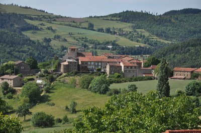
Vue du village - Ardèche Hermitage Tourisme Pailharès
Pailharès was no doubt a fortified stronghold as from the Roman era. During the Carolingian period the village covered a much greater area, the border lines of which are somewhat difficult to define today. In the article about the commandery of the Antonins of Aubenas, Doctor Francus (alias Albin Mazon) mentions a commandery of « Pailharès » being part of the commandery of Aubenas. Pailharès became an enclave of Forez in 1296. The village became part of the Vivarais region during the French Revolution. In 2003 it suffered a lot of damage after a forest fire caused by lightening on the Sardier hillside. Information source : Wikipédia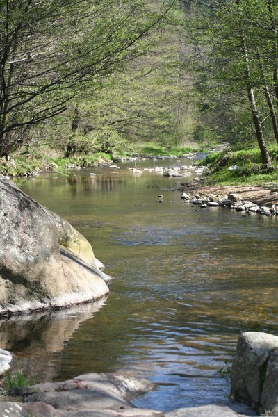
La Daronne en aval de Saint Félicien - Ardèche Hermitage Tourisme  Geology
The Daronne river and its ?????
The village of Pailharès is situated on the higher part of the Daronne catchment area. The catchment area is the entire zone that collects water and directs it towards a river and its tributaries. It is a sort of bottleneck that swallows up all the streams coming into the river. It therefore has its own boundaries : divides that naturally follow the mountain ridges. Rainfall falling on one side of the slope accumulates, running into the streams that finally go into the river Daronne that then flows into the river Doux, a tributary of the river Rhône. This same rainfall may also filter into gaps in the rock forming groundwater then coming out in spring forms and feeding various streams. On site, these many streams can be seen thanks to the presence of a specific vegetation (particularly water absorbing plants) such as bullrushes, birch, easily noticeable with its white bark, alder and willow , only to mention a few.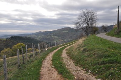
Point de vue sur la vallée de la Daronne - Ardèche Hermitage Tourisme PanoramaViewing point
Splendid views of the Daronne Valley and the French Alps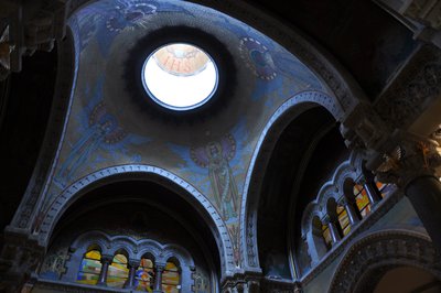
Choeur de la basilique - Ardèche Hermitage Tourisme Saint Régis in Lalouvesc
Reviving catholic faith in people from the hilly regions of Vivarais, Velay and Cevennes was the mission given to Saint Jean François Régis ! Ordained as a priest in 1630 and a missionary in 1632, this tireless walker used to cover 40 to 60 kilometres of ground every day. On 23rd December 1640, in a snowstorm, he left for what was to be his last mission in the North of the Vivarais region. He fell ill on the way and in spite of his high fever, he continued to pray and hear confession up to his last breath. On 31st December 1640 « God’s pilgrim » died in Lalouvesc at the age of 43. He received beatification in 1716 from the Pope Clément Xl and was canonized later on in 1737. Following that, Lalouvesc became a place of pilgrimage and a basilica was built in his name. Its building took 12 years to finish. The Basilica has two belltowers taken from two old churches. The final basilica was consecrated on 5th August 1877 by cardinal Guibert who was archbishop of Paris. The religious building houses relicas of the Saint and the stained glass windows present a visual review of his life. On the occasion of big events the tenor bell rings and can be heard for kilometres around. Information source : Topoguide "Le Chemin de Saint Régis" du Puy en Velay à Lalouvesc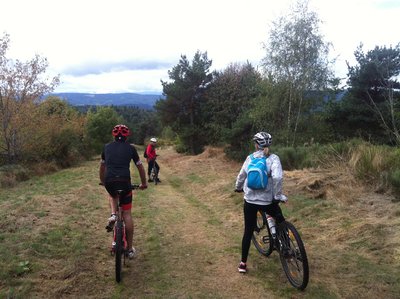
Vue de la descente du Bois de Versailles - Ardèche Sports Nature PanoramaViewing point
Facing the high Doux valley and the chaine des Sucs (volcanic hilltops) including the most impressive Mésenc and Gerbier de Jonc.
Vue depuis Bobigneux - Ardèche Sports Nature PanoramaViewing point
Beautiful views of the Ardèche hills, the Doux Valley and the Sardier hillsides which reveal the scars of the fire in 2003..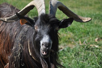
Bouc - Ardèche Hermitage Tourisme FaunaAnimal farming in the High Doux Valley
Upstream from Labatie d'Andaure, milk production and goat breeding are important activities. Beef cattle is mainly of the Montbéliard, Abondance and occasionally Tarine breeds. On steep pastures and areas of dense thicket, herds of goats, almost a tradition in Ardèche, spend their time grazing. In this particular area if sheep are few and far apart, goat breeding is on the other hand on an increase. Goat farmers can benefit from an agricultural program with two aims, the first for cheese production and the second for land maintainance. The latter is of great importance with the decline of agriculture, the encroachment of woodland on the landscape and the increasing dangers of fire. Tasting our Picodon and caillé doux goat cheeses is a must before leaving ! Information source : SIVU Doux Clair, Conservatoire Rhône Alpes des Espaces Naturels, la Vallée du Doux, un voyage aux multiples ambiances, Guide du patrimoine naturel de la région Rhône Alpes, 1995. Lake
LakeCoucard reservoir
More a fleeting pond, this reservoir exists only during the summer period due to a temporary dam on the Doux river : refreshing water guaranteed !- Panorama
Viewing point
On the way up to the left you can see the village of Lafarre perched on its rock spur The rocks of Peyrhomme
The numerous natural rocks, including a druidical altar, reveal human layouts with amazing sculptural representations. The whole mountainside was a sacred spot for the Celts and here was one of the borders between the Helvii and Vellavii people. An axe from the final neolithic period was found near Peyrhomme during the excavation of a house along with a representation of the God Bel extracted from the ravines. Ceramic fragments, characteristic of the pre-roman era, were also exposed and expert assessments have revealed the presence of promontory forts on the hilltop, natural defence systems made of earth with their access ramps, all evidence that there was once a fortified site on high ground, home to successive populations from -2500/-3000 before J.C. to the decline of the Roman empire in 4th century of our era. Source : Association Rochepaule pour Mémoire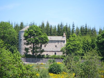
Vue d'ensemble du monument - Ardèche Hermitage Tourisme Commanderie de Devesset
In 1164, the order of Knights Hospitallers of St John of Jerusalem established a commandery in the village of Devesset. Just like the Knights Templar, the Knights Hospitallers or of Malta order was born during the crusades and wars to win back the Holy Land. Of an international dimension there are commanderies in countless countries. The one in Devesset is the largest of the priory in the region of Auvergne. Its possessions spread from the Rhône to the Allier. Its main activity was hospitality and welcomed pilgrims en route for the town of le Puy en Velay. There’s a tale that says « hard times » had come, so the commander hid his treasure in an old bell that was carried, one moonless and starless night, to a « bourbo » (marshland) exactly where the present lake is now and that as soon as the treasure was put down it sank deep into the depths of the earth. Since then, no one has ever found the treasure… After being destroyed then rebuilt again before a fire nowadays all that can be seen of the old commandery is a turret that has been restored and listed amongst historical monuments.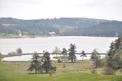
Vue d'ensemble du lac - Ardèche Hermitage Tourisme  Flora
FloraLake of Devesset
A magnificent lake covering around 50 hectares, Devesset is situated in a natural and green haven. All around the lake, well-known as a tourist destination, there are forests, fields, broom shrub and bullrush moors and clearings, full of fireweed, form a mosaic pattern in a variety of settings. In the right season, purple marshlocks, white marsh grass, white cotton grass, sundew insect eaters, marsh gentian with their trumpet-shaped, green and blue striped flower all bloom in the peatbogs and fields of peat round the close edge of the water. Other than the plants, studies have shown the presence of over 80 species of birds, 19 dragonflies, and 17 butterflies amongst them the very rare Algon Blue, a small butterfly with azur blue wings and a life cycle depending on the coexistance with a flower and an ant. And the beaver ? Don’t count on it. The time of day doesn’t suit this nocturnal party animal. You’ll just have to be contented with the traces he leaves behind : cut branches, pencil-sharpened tree-stumps. Information source : Henri Bariol
Description
1 – St Félicien
Cross the square in front of the tourist office, turn left past the old butcher’s shop then right in front of the porch.
2. The park
Go straight on. At the fork go left round the top of the park. Continue up the main road and turn left after the sign indicating you are leaving the village. The road becomes a track.
3. Châtelas
Follow the main path becoming a grass track. Go through the stile entering into the property of the Château de Rosières. Go towards the gate and leave via the second stile. Turn left in front of the house and its porch. The path becomes a lane leading to the main road.
4. Pont de Maillotière
Go up the main road for a few hundred metres. When the slope eases off turn left and go down towards the hamlet of Crapanne. Turn right at the house up the incline. At the first crossroads turn right along the path following the river. Cross the wooden bridge and go through the following hamlet. Follow the path above the hamlet then the track along the stream on the right.
5. La Croze de Marron
Follow the small road on the left for a good kilometre then the steep incline towards the right. A little further on, a path on the right takes you up through fields and orchards.
6. Priolat
Follow the main path going up towards the village of Pailharès.
7. Pailharès
Follow the road leading to Col du Marchand just below the restaurant then first left downhill. The road becomes a path after the last hamlet taking you down into the glen then onto a steep uphill slope on a stone path. The path comes out onto a small road . Turn left here. When you get to the first houses follow the path opposite them, leading to the road above where you turn right.
8. Le Clos de Pierre Martin
Follow the panoramic grassy path along the hillside to the right.
9. Les Granges
Go straight on at the big chestnut tree facing you, along the pleasant path entering the wood. Cross a small, very often dry, stream, go past the isolated stone house and turn right downhill towards another glen. Turn onto the path on the left before the steep slope over the other side. The path leads onto a track taking you to the main road and le Col du Marchand.
10 - Col du Marchand
Take the path between the road to Satillieu and the level forest track. Further down you will come out onto the main road. Go along the road for a few metres before turning right onto the chemin du Buisson.
11 – Le Buisson
Continue along the main path that goes slowly uphill. At the fork turn onto the lower path. Go through the stile on the edge of the field. Go down a few hundred metres and turn left onto the path going round the glen.
12 – Combe
Follow carefully the signposts at this point (many different routes). Turn off to the right onto the small grassy forest path coming onto a higher track just after the bend. Turn left. When you come to the crossroads go straight over onto the steep pebble track (perhaps need to push the bike here) Turn left onto a continuous, however very pleasant, track in a dark forest with a lot of mosslike growth. The path brings you out onto an uphill track towards Lalouvesc.
13 – Le Bois Noir
Go past the water treatment plant and into the centre of the village.
14 – Lalouvesc
Follow the main road towards Saint Bonnet le Froid. After the crossroads of Rochpaule turn onto the grassy path between the houses leading to the road above.
15 – Les Croisières
Turn left onto the main road as if going down towards Lalouvesc.
16 – Chante Aucel
Follow the pretty track between fields leading into the woods named Versaille. Go straight on, the path levels off first then goes downhill. A few kilometres on turn right onto the road to Rochepaule. Go through the hamlet and turn right onto the grassy path just before the last house. Go down to Val d’Or dale then over the wooden bridge guarded by its wood-carved legendary dwarf. Facing you take the easy-going path leading to the small lane. Carry on along the steep path on the other side for thirty to forty metres.
17 – Les Sagnes Nord
Turn left onto the enjoyable slightly downhill single track. A short craggy and steep slope takes you across the small lane again.
18 – Bobigneux
Turn immediately onto the path, through fields and forest, going down into the Vallée du Doux.
19 – Chaude Oreille
Turn slightly right onto the path going into the glen. Cross the stream coming out just below the house and turn onto its drive. It will bring you out in the large bend on the small road. Follow the road downhill to the edge of the Doux river. Cross the stone bridge before tackling the steep slope leading to the road above.
20 - Armand
Continue on the uphill road in front of you. At the end turn right onto the path going past the houses of La Côte. The path is steep going into a wood of chestnut trees. At the crossroads 4 chemins turn left onto the slightly uphill path. Go past a crossroads and follow the path above the isolated house. Further up join the track and continue downhill. After the second bend turn right then when you reach the road follow it uphill. On the third bend leave the road and continue on the obvious path. Go past the house and take the path on the right through a pine forest. The downhill slope leads to Roches de Peyrhomme in a very open and mineral environment offering a breathtaking view. Follow the quite technical overlooking path to the village of Rochpaule.
21 – Rochepaule
Follow the main road towards Saint Agrève. Turn right onto the small lane after the dell going through a small pass then downhill. At the bend leave the road onto the lane in front of you becoming a track and going past ruins. Cross the cool glen with its tiny cascades onto the pleasant path running along the other side. Use the wooden steps to join a small road.
22 – Bruas
Turn right onto the road that becomes a track. Go round the glen coming out onto a small road over the other side. Go downhill about 30 metres and turn onto the pleasant forest track with small stone retaining walls. Carry on for a few kilometres then turn right onto a relatively steep path that becomes rough ground before arriving at the plateau (need to push the bike for about 10 minutes). On the small road you are on the plateau and heading to the main road.
23 – La Chaumette
Cross the road towards Devesset lakeside.
24 – Pioulouse
Go past the lovely stone barn on the edge of the lake then over the square onto the path along the campsite. This will take you back to the main road which you cross again.
25 – Lérenier
Turn right onto a very good track taking you to the top of the village of Devesset then down to the village itself through small streets.
26 – Devesset
Easy-going paths and small roads then follow. Go through the glen and follow the small road at the top on the other side. Head South for a few hundred metres then go into the fir tree forest. Go past some houses coming out at the Auberge L’Oustau. Follow the path above it.
27 – Les bleuets
Go back to the lakeside continuing for a few kilometres before crossing over the dam and coming back down the other side.
28 – Le lac
Turn sharp right up a steep slope full of tree roots. The path levels off further on. When you reach the farm go round it on the right then head south on roads and forest tracks.
29 – La Rèche
Keep heading south until you get to Saint Agrève.
- Departure : Saint Félicien - Post office car park
- Arrival : Saint-Agrève - Rue du docteur Tourasse
- Towns crossed : Tournon-sur-Rhône, Saint-Jean-de-Muzols, Lemps, Vion, Sécheras, Cheminas, Saint-Victor, Étables, Colombier-le-Vieux, Bozas, Saint-Félicien, Pailharès, Vaudevant, and Lalouvesc
Altimetric profile
Information desks

6, place du 8 mai 1945 - BP 70019, 26601 Tain l'Hermitage
Transport
Bus route N° 11 Tournon sur rhône - Saint Félicien - Lalouvesc equipped with bike-rack during the summer season.
Access and parking
Follow the D238 from Tournon sur Rhône then the D532 to Saint Félicien.
Parking :
Post office car park
More information
Report a problem or an error
If you have found an error on this page or if you have noticed any problems during your hike, please report them to us here: