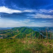
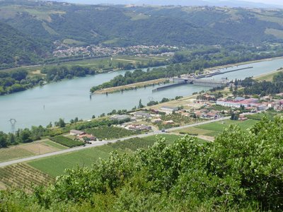
The viewpoint of Méjeans

Crozes-Hermitage
The viewpoint of Méjeans
Easy
2h30
7,2km
+229m
-230m
Embed this item to access it offline
4 points of interest

Tombstone of Knight of Urre
It is quite unusual to find yourself standing in front of this tombstone on the church square ! The Urre family related to the Adhémars and named after no doubt the area in the Drôme Valley called Eurre that was already their property in Xllth century. This name is linked to the Knights Hospitallers of St John of Jerusalem which was a religious order that arose during crusades and supported the hospitals of Jerusalem. Panorama
Viewing point
Viewing point Flora
FloraGranite and its flora
Between the towns of Crozes Hermitage and Gervans granitic soils, renowned for their vineyards, are a geological continuity of the Massif Central region. Various succulent plants grow on the arid bluffs whilst others like fescues, box trees, blackthorn prefer the grassy slopes. Woody bushes, sage-leaved rockrose and heather make an edging to the woodlands of white oak trees.
Belvédère des Méjeans - Ardèche Hermitage Tourisme  Panorama
Méjeans viewing point
Méjeans viewing point
Description
1 - Church - 145 m
Turn right up the steps to the top of the housing estate. Bear right until you get to the uphill road on the left. Turn on to the road and continue ahead until it becomes a wide, sandy track. After 30 minutes of walking uphill go past the houses coming to a road.
2 - Les Bruclas - 340m
Turn left towards belvédère des Méjeans. At the following junction turn left and carry on to a small parking area then the viewpoint information board (road ends here). Here, on the left, a small track starts amongst bushes going down in undergrowth to a gully. Cross the stream and go up the other side taking you to a track cutting across in front of you. Turn left and carry on down past the cross on the right side then further down turn right onto a wider path. Go over the bridge then uphill to the junction where you turn left.
3 - Gervans - 140m
Turn left and go downhill.
4 - Chemin des Vousères - 130m
Take the path along the railway track. After just over 1km return to the village of Crozes by the road.
- Departure : Crozes Hermitage - Church car park
- Arrival : Crozes Hermitage - Church car park
- Towns crossed : Crozes-Hermitage, Larnage, and Gervans
Altimetric profile
Information desks
6, place du 8 mai 1945 - BP 70019, 26601 Tain l'Hermitage
Access and parking
Follow the N7 towards Saint Vallier then right onto the D163 to Crozes Hermitage
Parking :
Church car park
Report a problem or an error
If you have found an error on this page or if you have noticed any problems during your hike, please report them to us here:

