Tour du Pays de Saint Félicien - Stage 1 : Bozas - Col du Marchand

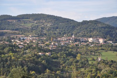
Bozas
Tour du Pays de Saint Félicien - Stage 1 : Bozas - Col du Marchand
Hard
6h
17,2km
+832m
-473m
Embed this item to access it offline
6 points of interest
Village avec le château en son sein - ADSEA 
The château of Bozas
This château is made of " three wings arranged round a small inner courtyard, closed from the east side by a wall with a postern cutting through it " It was built between Xlllth and XVth century no doubt. At the end of the XVlllth century the village Marquis had an important extension added on.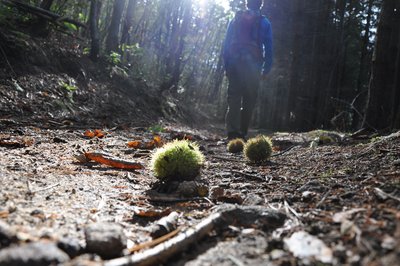
Voie antique de Malaurier - Ardèche Hermitage Tourisme 
Roman way of Malaurier
A stone-paved path out in the countryside…. Quite intriguing and it makes us wonder if these paving stones have experienced the walking steps of “caligae” (Roman legionnaires’ sandals) Rather difficult nowadays to confirm if that was the case. However, the oppidum above the village of St Symphorien de Mahun and the Roman bridge ruins in Boucieu le Roi and in Tournon sur Rhône make it quite possible for it to have been a communication route across the plains of Ardèche. At that time roads were built on the smoothest terrain to make travelling easier. An example of this is the route going from Lamastre to annonay. If you close your eyes you can hear Gauls singing in the distance and you might even find some mistletoe to add to your magic potion. Luckily we are aware today that the berries are poisonous !
 Panorama
Viewing point
Viewing point overlooking the meandering Doux river.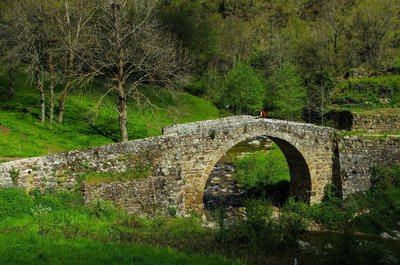
Pont au niveau du moulin - David Genestal - Carnet de Rando Gaillards Mill
Excellent evidence of how the Haut Vivarais is a geographically scattered housing region. Nature’s resources of have always been used in this area. The lack of wind forced people to use water. Water mills enabled the development of the earliest industries where wood was cut and grain and chestnuts were ground. Also called the bread tree, the chestnut tree prevented the county of Ardèche from famine on many occasions due to the high content in protein of its fruit. It is said that the life of the people of Ardèche is closely linked to that of the chestnut tree in many ways. Babies were rocked in cradles made from chestnut wood, chestnut leaves were used to feed cattle when fodder was lacking, its fruit was a main food, its wood was used for burning and people were buried in chestnut coffins. Quite a lovely story don’t you think ?
Montée du Moulin des Gaillards - Ardèche Hermitage Tourisme PanoramaViewing point
An enhancing landscape gradually comes into view revealing the Daronne valley and the old bridge down below- Panorama
Viewing point
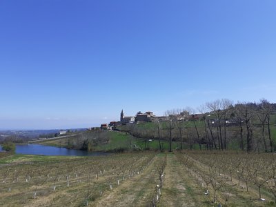
As you go down look to your right to see a splendid view of the village of Pailharès situated above the river Daronne.
Description
The walk starts at the « Info rando » information board in front of the château.
1 – Bozas – 530m Follow Malaurier 2km Saint Félicien 6.3km
Go down the small road to the junction in the same direction. Continue down and along the pond before walking uphill again. Go past the crossroads le Murier then leave the road turning left onto an ascending path. At the top of the path go through a cherry orchard then enter the wood going down to Malaurier.
2 – Malaurier – 520m – Follow Saint Félicien 4.3km
Turn right onto the small road going downhill. Take the path on the left and pass Perdriolle farm. Continue downwards through the orchard and turn right onto the small lane in front of the building Jacquillon heading towards the D234 main road. Continue left towards Pierrageay.
3 – Pierrageay – 405m Follow Moulin des Gaillards 3.6km Saint Félicien 6.4km
Continue along the D234 then turn left onto the small road going uphill. On the bend bear right and go to the end of the road in Raillon.
4 – Raillon Follow Moulin des Gaillards 1.2km Saint Félicien 4.4km
To the left of the hamlet go up the path that emerges into the wood. Follow the path down into a field then the track leading to it towards les Gaillards. Turn right into the hamlet of les Gaillards and follow the downhill track opposite entering the woods. The river Daronne is on your right.
5 -Moulin des Gaillards – 473m Follow Saint Félicien 2.8km
With the river Daronne behind you go up the road then take the small path on the left taking you to a farm. Pass the farm on the right. Follow the main road on the left then turn right onto a path going uphill.
6 – Châtelas- 550m Follow Pailharès 6km
Follow a pretty level path, go through the woods of the château de Rosières. Pass the hamlet Le Grand Médier and go down to the road leading to Pailharès. Careful when crossing the road.
7 – Pont de la Maillotière – 511m Follow Pailharès 3.6km
Take the D273 road and continue ahead for 1.2km. At la Cote 538m turn left towards houses. Continue through fields towards La Croze de Marron.
8 – La Croze de Marron – 550m Follow Col du Marchand 3.7km Lalouvesc 7.9km
Go up the small path through fields, cross the Saint Félicien road onto the path opposite. Go through a forest of old chestnut trees and pine trees before crossing a stream. Continue climbing to the hamlet Le Mazel. Turn left in the hamlet then immediately right taking you up to the road.
9 – Le Clos de Pierre Martin – 739m Follow Col du Marchand 2.2km Lalouvesc 6.4km
Cross the road heading towards Col du Marchand. Continue opposite above the hamlet.
10 – Les Granges – 730m Follow Col du Marchand 1.7km Lalouvesc 5.9km
Follow the main path. Pass a dell then you come to a fork 200m further on. Turn right downhill, step over a small stream and bear left onto a windy uphill slope through thicket. This leads to a track going up to the main road. Turn left on the road and continue to le Col du Marchand.
- Departure : Bozas - Church square
- Arrival : Col du Marchand
- Towns crossed : Bozas, Saint-Félicien, and Pailharès
Altimetric profile
Information desks

6, place du 8 mai 1945 - BP 70019, 26601 Tain l'Hermitage
Transport
Bus route N° 7 Annonay - Saint Félicien - Lamastre. Bus stop Bozas Croix des champs
Access and parking
Follow the D234 from Saint Félicien then the D278 towards Lamastre then the D272a as far as the village of Bozas
Parking :
Church square
More information
Report a problem or an error
If you have found an error on this page or if you have noticed any problems during your hike, please report them to us here: