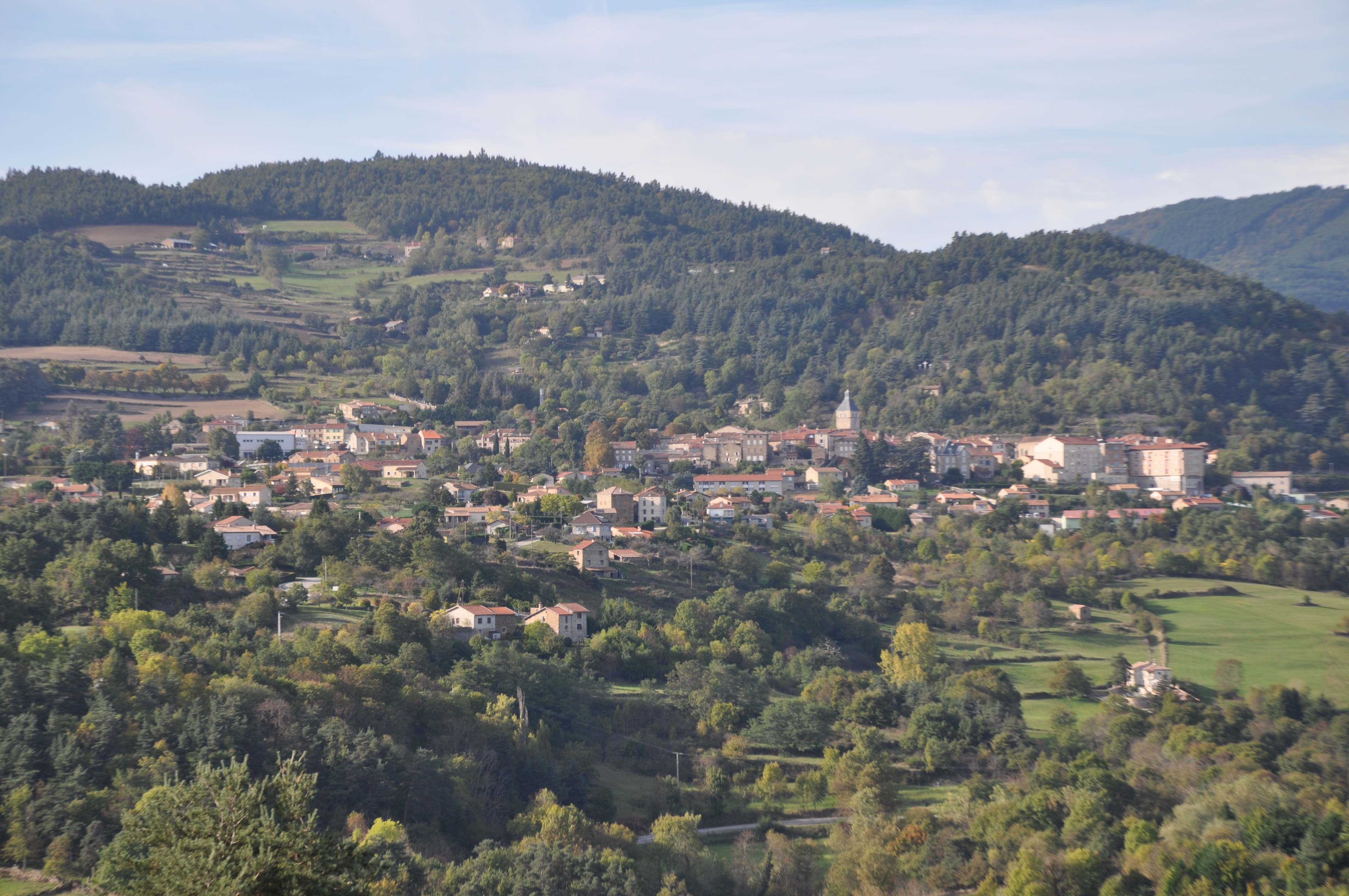
Bozas
Hard
3j
51,5km
+1727m
-1727m
Embed this item to access it offline
15 points of interest
Village avec le château en son sein - ADSEA 
The château of Bozas
This château is made of " three wings arranged round a small inner courtyard, closed from the east side by a wall with a postern cutting through it " It was built between Xlllth and XVth century no doubt. At the end of the XVlllth century the village Marquis had an important extension added on.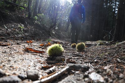
Voie antique de Malaurier - Ardèche Hermitage Tourisme 
Roman way of Malaurier
A stone-paved path out in the countryside…. Quite intriguing and it makes us wonder if these paving stones have experienced the walking steps of “caligae” (Roman legionnaires’ sandals) Rather difficult nowadays to confirm if that was the case. However, the oppidum above the village of St Symphorien de Mahun and the Roman bridge ruins in Boucieu le Roi and in Tournon sur Rhône make it quite possible for it to have been a communication route across the plains of Ardèche. At that time roads were built on the smoothest terrain to make travelling easier. An example of this is the route going from Lamastre to annonay. If you close your eyes you can hear Gauls singing in the distance and you might even find some mistletoe to add to your magic potion. Luckily we are aware today that the berries are poisonous !
 Panorama
Viewing point
Viewing point overlooking the meandering Doux river.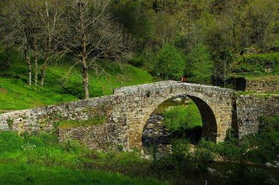
Pont au niveau du moulin - David Genestal - Carnet de Rando Gaillards Mill
Excellent evidence of how the Haut Vivarais is a geographically scattered housing region. Nature’s resources of have always been used in this area. The lack of wind forced people to use water. Water mills enabled the development of the earliest industries where wood was cut and grain and chestnuts were ground. Also called the bread tree, the chestnut tree prevented the county of Ardèche from famine on many occasions due to the high content in protein of its fruit. It is said that the life of the people of Ardèche is closely linked to that of the chestnut tree in many ways. Babies were rocked in cradles made from chestnut wood, chestnut leaves were used to feed cattle when fodder was lacking, its fruit was a main food, its wood was used for burning and people were buried in chestnut coffins. Quite a lovely story don’t you think ?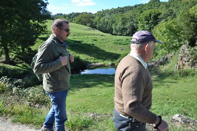
Montée du Moulin des Gaillards - Ardèche Hermitage Tourisme PanoramaViewing point
An enhancing landscape gradually comes into view revealing the Daronne valley and the old bridge down below- Panorama
Viewing point
As you go down look to your right to see a splendid view of the village of Pailharès situated above the river Daronne. The Afars
The Afars (kind of goblin) are shady, countryside characters. They live together as a family in natural hollows such as la grotte de la chèvre at la Roche Berne in Vaudevant. How do we recognize them ? The Afars are men and women smaller than humans, rather more the size of a child. They have pointed ears and their one eye in the middle of the forehead makes them look similar to a cyclops ! Most of the time they are without clothes but occasionally may wear leaves as covering. However, you will never see them during the day as they are nocturnal creatures. As soon as it’s dark, they come out to go scrumping. They pilfer vegetables in gardens along with linen and other objects. They milk the farmers’ cows to feed their children. On odd occasions one or two might get caught due to clumsiness caused by stolen boots and clogs much too big for them. They speak the Occitan dialect so convincingly that they never stay captured for very long as their captors always finish by feeling sorry for them and letting them go free ! Information source : Revue Lo Grinhon N°6 - 1990. Small patrimony
The cross of Montplot
Joannès Dufaud (parlarem en Vivarés edition 2004) describes it as a mountain of timber and wood stumps or quite simply a mountain where trees are logged and cut into ¾-metre lengths as in a wood yard. We can in fact observe here, that the way of working hasn’t changed much over the years. Information source : Ardèche Sports Nature.- Small patrimony
The terraces
In this area "Chalets" is the word used to describe terraces on slopes making them useable for various cultures. Most of the terraces were built in XVlllth and XlXth centuries. At that time, the population, 90% of which were farmers, was on an increase. Always looking for land to cultivate, quite simply to survive, the latter were forced to use the steep slopes. Vine growing was also on an increase during that same period and necessitated arable land. Building terraces was the answer; increasing surfaces for growing and at the same time making the slopes easier to use, enabling water retention and controlling it, keeping the soil from erosion and restoring the heat absorbed by the rock-stone during the day. Little by little the use of these "chalets" was abandoned due to various plant diseases at the end of the XlXth century, particularly Mildew and Phylloxera that destroyed whole vineyards and crippled farming. However, rural depopulation, the number of lives lost during the first World War and the mechanization of farming down in the lower plains were the main reasons for terraces being abandoned. As you stroll along you will discover a landscape shaped by these « farmer builders”. Here, amongst this stone architecture, traces are particularly visible, making it easy to imagine the magnitude of the task. 
L'ancienne école privée - Ardèche Hermitage Tourisme Deyras
One of the three hamlets having given birth to the current village of Saint Victor. Even if we are not exactly on unified land here, in 1937 the « deyrasiens » (people of the hamlet of Deyras) asked for their independence which was refused. The church is one of the three bell towers of Saint Victor (born from the joining up of 3 hamlets, Saint Victor, Deyras and Navas). Its statue of the Virgin Mary dating back to 1886 is built on a plot of land belonging to a lady called Madame de l’Hermuzière who was a very important person in the history of the town of Annonay as she founded the convent belonging to the Ursulines order. Don’t miss the beautiful panorama of fruit orchards around you and the view overlooking the beginning of the river Daronne gorges.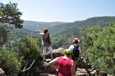
Plateforme dominant les gorges - Ardèche Hermitage Tourisme PanoramaViewing point
Splendid view looking down into the intertwining Daronne Gorges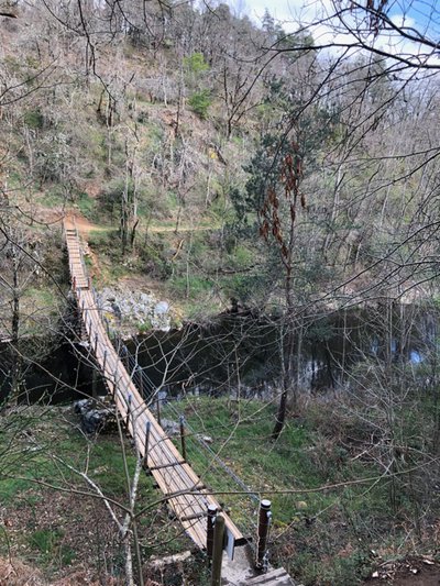
Myriam Gery The footbridge of Saint Sorny
Installed in 2007, this footbridge enables you to cross the river Daronne. You are here, at the heart of l’espace naturel sensible (sensitive nature zone) of the river Daronne gorges. However this cable bridge is not the first one crossing the river as long ago, the villages of Colombier le Vieux and Saint Victor were already linked by a bridge used mainly by farmers going to the market to sell their produce. We can easily imagine their consternation when the original bridge was carried away by floods in 1963 !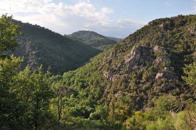
Point de vue au sommet de la colline derrière Saint Sorny - Ardèche Hermitage Tourisme  Fauna
FaunaThe secret nature of the Daronne Gorges
Only a few kilometres from the Rhône Valley discover the Daronne Gorges ; a secluded haven make it an exceptional site part of a zone recently labelled "Espace Naturel Sensible" (sensitive nature zone) by the county authorities. A walk full of surprises through this breathtaking, secretive valley being at the same time so close yet so remote. To make the most of this educational trail make sure you have the appropriate kit. So on with your walking boots ! Find details about the trail on site (kit can be purchased in our tourist offices).- Panorama
Viewing point
Splendid view overlooking the Daronne Gorges 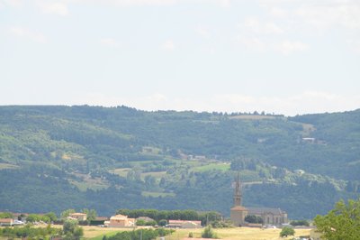
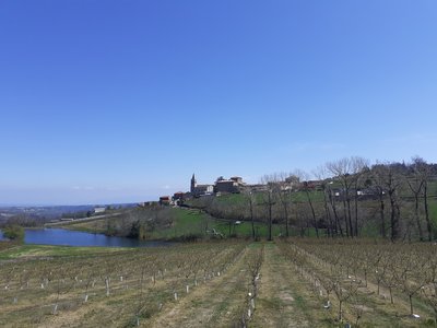
Village de Colombier le Vieux - Ardèche Hermitage Tourisme Colombier le Vieux
Bordered by the Daronne and Doux rivers’ gorges the village of Comombier le Vieux dominates the surrounding landscape. Other than its undeniable nature heritage, you will also find beautiful traces of lordship architecture dating back to XVlth century with the château de Bellecombe recently restored aliong with the fortified manor house of Ruissas. Colombier le Vieux was used to illustrate the book La Maison Rouge by Maurice Genevoix. The latter tells how the village was passed to the Huguenots and targeted by a troop paid by the catholics. A book to enjoy reading.
Description
1 -
Day 1 : Bozas - Col du Marchand Day 1
Day alternative : Bozas Corsas 2
2 -
Day 2 : Col du Marchand Corsas
3 -
Day 3 : Corsas - Bozas
Day 2 2-day alternative : Corsas Bozas
Day 1 : Bozas - Col du Marchand Day 1
Day alternative : Bozas Corsas 2
2 -
Day 2 : Col du Marchand Corsas
3 -
Day 3 : Corsas - Bozas
Day 2 2-day alternative : Corsas Bozas
- Departure : Bozas - Church square
- Arrival : Bozas - Church square
- Towns crossed : Bozas, Saint-Félicien, Pailharès, Vaudevant, Saint-Victor, and Colombier-le-Vieux
Altimetric profile
Information desks

6, place du 8 mai 1945 - BP 70019, 26601 Tain l'Hermitage
Transport
Bus route N° 7 Annonay - Saint Félicien - Lamastre. Bus stop at Bozas Croix des Champs
Access and parking
Follow the D234 from Saint Félicien then the D278 towards Lamastre then the D272a to the village of Bozas
Parking :
Church square
More information
Report a problem or an error
If you have found an error on this page or if you have noticed any problems during your hike, please report them to us here: