Via the Red and Blue Crosses
Bren
Via the Red and Blue Crosses
Easy
2h30
8,3km
+298m
-297m
Embed this item to access it offline
2 points of interest

 Small patrimony
Clever planning
The village of Bren has a very important water supply network. Horizontal wells were established in 1840 collecting water from the surface of the water table and directing it to different reservoirs, wells, fountains and water distributors used by farmers as well the domestic home.- Small patrimony
Water in la Drôme des Collines
The Drôme des Collines (hilly Drôme)is a region full of streams and rivers : Rhône, Isère, Galaure, Veuze, Joyeuse, Savasse, Chalon, Herbasse, Veaune... Very soon planning and construction was necessary in order to use them for the irrigation of land, industrial activities and small businesses not forgetting domestic use.
Description
Starting from the village square, head for the slightly uphill street opposite the townhall. Follow the road for 1km
1 - Combe de Chaloray - 277 m Turn right onto the road going uphill for 200m then, keeping to the left, go past the stone farmhouse. Continue on the grass track then turn right and go uphill on the path going between oak trees. When you come out of the wood go past a building to reach the track going up on the right. Follow the path for 300m then turn left.
2 - Combe de Pélorset - 345 m Go uphill towards la croix bleue. When you get to the cross, carry on left up to the farm. From here there is a beautiful panorama of the Vercors mountain range. Round the back of the farm take the path leading straight up into the woods la Garde. Continue ahead on the path for about 600m until you reach the junction. Turn right onto the downhill path. Follow the main path until you reach the bottom of the dell then go onto the sandy track taking you to the crossroads.
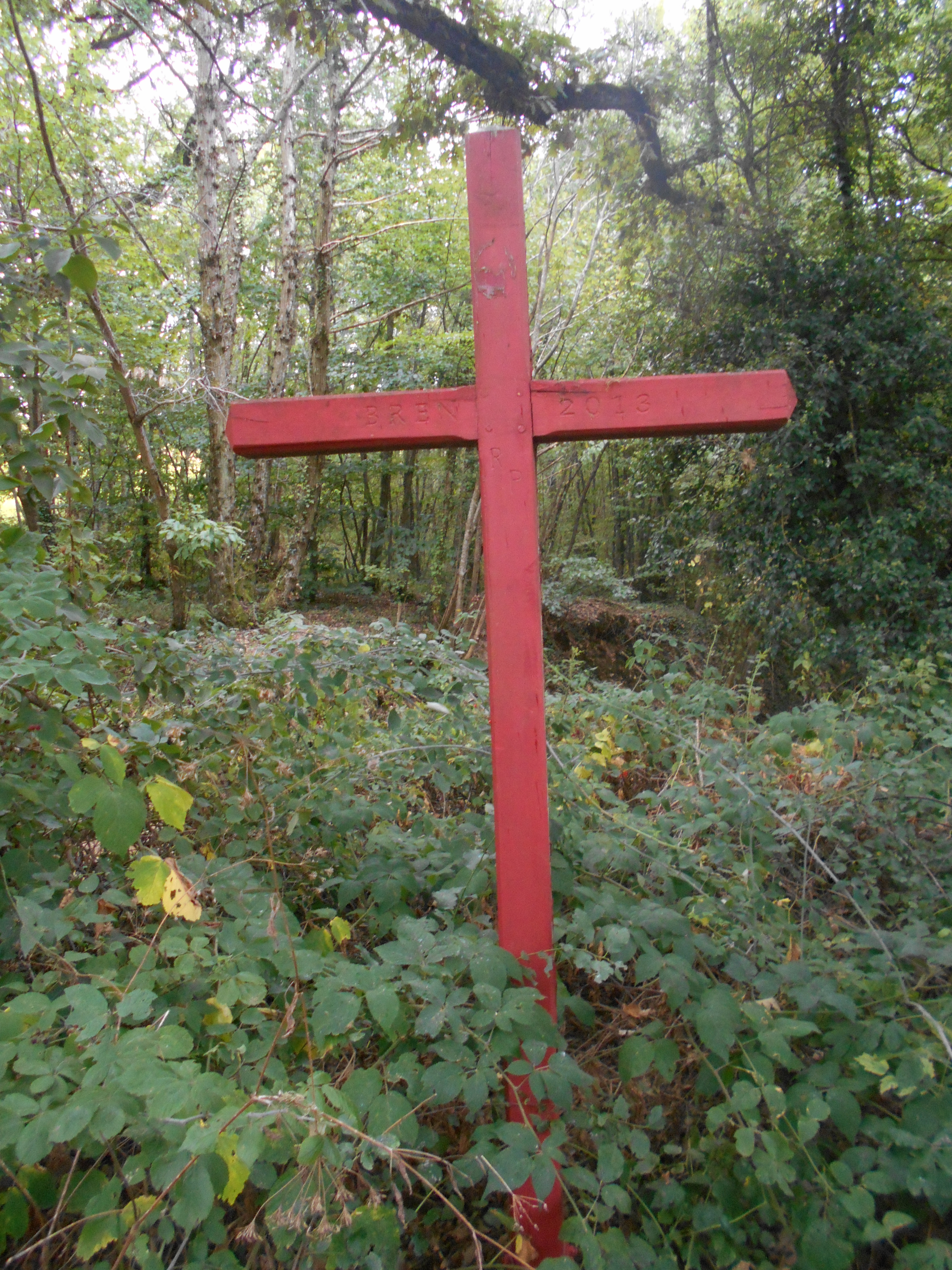
3 - Les Verrières - 250 m At the big post go left uphill towards chemin de Saint Andéol. Go along the track for about 1km then go round the field (on your left). Pass close to a big stone house and carry on along the main path to the road. Continue ahead for about 300m until you see a big oak tree on your left. At this point leave the road for a grass path going up on your left. Continue to the red cross. To the right at the back of the cross go down the path through woodland. Once at the bottom (about 800m further down) you come onto the chemin de Saint Andéol.
4 - Chemin de Saint Andéol - 277 m Turn left and go 200m to reach the Combe de Chaloray.
1 - Combe de Chaloray - 277 m Turn right and retrace your steps back to the village.
1 - Combe de Chaloray - 277 m Turn right onto the road going uphill for 200m then, keeping to the left, go past the stone farmhouse. Continue on the grass track then turn right and go uphill on the path going between oak trees. When you come out of the wood go past a building to reach the track going up on the right. Follow the path for 300m then turn left.
2 - Combe de Pélorset - 345 m Go uphill towards la croix bleue. When you get to the cross, carry on left up to the farm. From here there is a beautiful panorama of the Vercors mountain range. Round the back of the farm take the path leading straight up into the woods la Garde. Continue ahead on the path for about 600m until you reach the junction. Turn right onto the downhill path. Follow the main path until you reach the bottom of the dell then go onto the sandy track taking you to the crossroads.
3 - Les Verrières - 250 m At the big post go left uphill towards chemin de Saint Andéol. Go along the track for about 1km then go round the field (on your left). Pass close to a big stone house and carry on along the main path to the road. Continue ahead for about 300m until you see a big oak tree on your left. At this point leave the road for a grass path going up on your left. Continue to the red cross. To the right at the back of the cross go down the path through woodland. Once at the bottom (about 800m further down) you come onto the chemin de Saint Andéol.
4 - Chemin de Saint Andéol - 277 m Turn left and go 200m to reach the Combe de Chaloray.
1 - Combe de Chaloray - 277 m Turn right and retrace your steps back to the village.
- Departure : Bren - In front of the townhall
- Arrival : Bren - In front of the townhall
- Towns crossed : Bren and Saint-Donat-sur-l'Herbasse
Altimetric profile
Information desks

6, place du 8 mai 1945 - BP 70019, 26601 Tain l'Hermitage
Transport
Bus route N°9 Romans sur Isère - Saint Donat sur l'Herbasse - Saint Vallier
Access and parking
Follow the D112 from Saint Donat sur l'Herbasse to Bren.
Parking :
Townhall
More information
Report a problem or an error
If you have found an error on this page or if you have noticed any problems during your hike, please report them to us here: